Chayut Wongkamthong
Toward Data-Driven STAP Radar
Jan 26, 2022


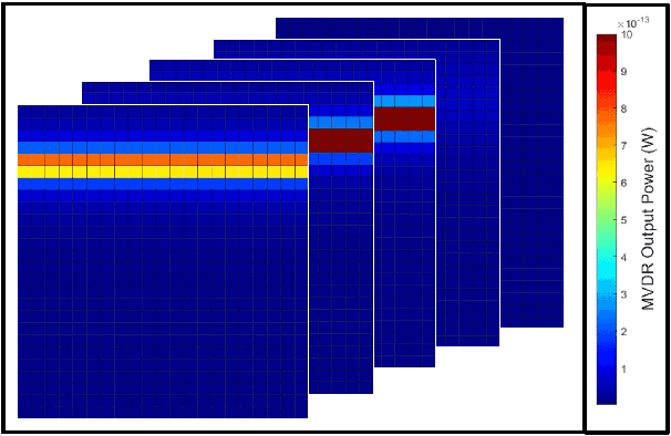
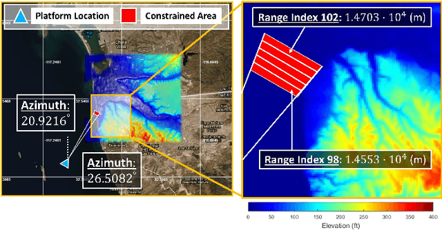
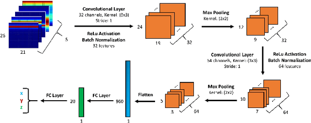
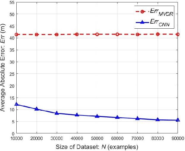
Abstract:Using an amalgamation of techniques from classical radar, computer vision, and deep learning, we characterize our ongoing data-driven approach to space-time adaptive processing (STAP) radar. We generate a rich example dataset of received radar signals by randomly placing targets of variable strengths in a predetermined region using RFView, a site-specific radio frequency modeling and simulation tool developed by ISL Inc. For each data sample within this region, we generate heatmap tensors in range, azimuth, and elevation of the output power of a minimum variance distortionless response (MVDR) beamformer, which can be replaced with a desired test statistic. These heatmap tensors can be thought of as stacked images, and in an airborne scenario, the moving radar creates a sequence of these time-indexed image stacks, resembling a video. Our goal is to use these images and videos to detect targets and estimate their locations, a procedure reminiscent of computer vision algorithms for object detection$-$namely, the Faster Region-Based Convolutional Neural Network (Faster R-CNN). The Faster R-CNN consists of a proposal generating network for determining regions of interest (ROI), a regression network for positioning anchor boxes around targets, and an object classification algorithm; it is developed and optimized for natural images. Our ongoing research will develop analogous tools for heatmap images of radar data. In this regard, we will generate a large, representative adaptive radar signal processing database for training and testing, analogous in spirit to the COCO dataset for natural images. As a preliminary example, we present a regression network in this paper for estimating target locations to demonstrate the feasibility of and significant improvements provided by our data-driven approach.
 Add to Chrome
 Add to Firefox
 Add to Edge