SoybeanNet: Transformer-Based Convolutional Neural Network for Soybean Pod Counting from Unmanned Aerial Vehicle (UAV) Images
Paper and Code
Oct 16, 2023


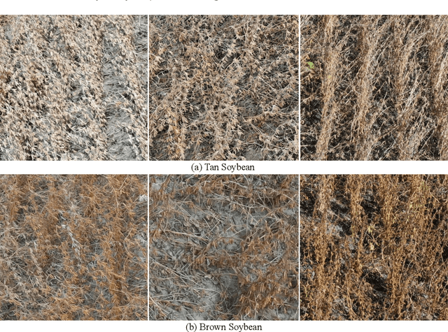
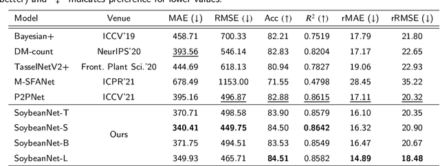
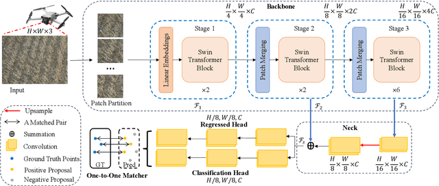
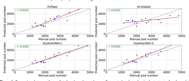
Soybeans are a critical source of food, protein and oil, and thus have received extensive research aimed at enhancing their yield, refining cultivation practices, and advancing soybean breeding techniques. Within this context, soybean pod counting plays an essential role in understanding and optimizing production. Despite recent advancements, the development of a robust pod-counting algorithm capable of performing effectively in real-field conditions remains a significant challenge This paper presents a pioneering work of accurate soybean pod counting utilizing unmanned aerial vehicle (UAV) images captured from actual soybean fields in Michigan, USA. Specifically, this paper presents SoybeanNet, a novel point-based counting network that harnesses powerful transformer backbones for simultaneous soybean pod counting and localization with high accuracy. In addition, a new dataset of UAV-acquired images for soybean pod counting was created and open-sourced, consisting of 113 drone images with more than 260k manually annotated soybean pods captured under natural lighting conditions. Through comprehensive evaluations, SoybeanNet demonstrated superior performance over five state-of-the-art approaches when tested on the collected images. Remarkably, SoybeanNet achieved a counting accuracy of $84.51\%$ when tested on the testing dataset, attesting to its efficacy in real-world scenarios. The publication also provides both the source code (\url{https://github.com/JiajiaLi04/Soybean-Pod-Counting-from-UAV-Images}) and the labeled soybean dataset (\url{https://www.kaggle.com/datasets/jiajiali/uav-based-soybean-pod-images}), offering a valuable resource for future research endeavors in soybean pod counting and related fields.
 Add to Chrome
 Add to Firefox
 Add to Edge