 Add to Chrome
 Add to Firefox
 Add to Edge
GAIA: A Global, Multi-modal, Multi-scale Vision-Language Dataset for Remote Sensing Image Analysis
Paper and Code
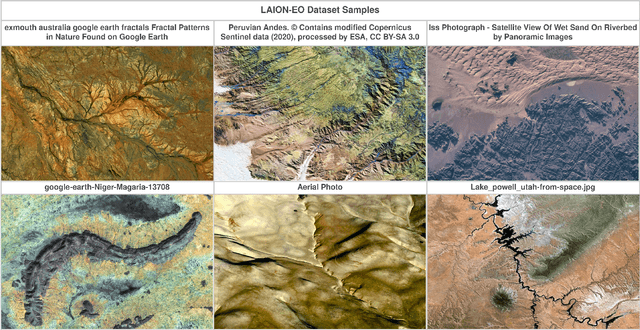
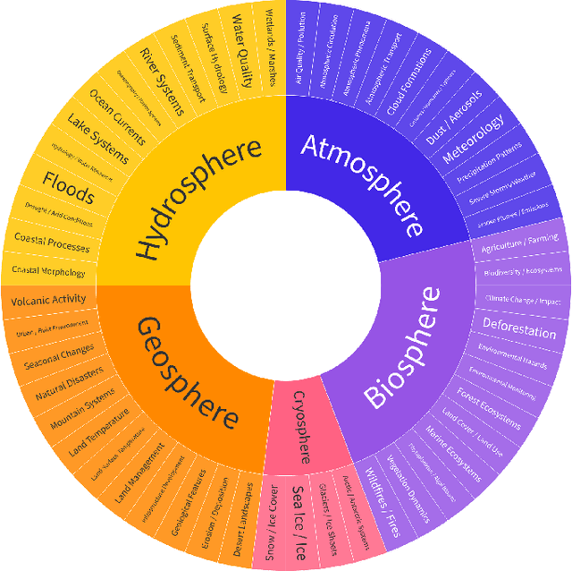
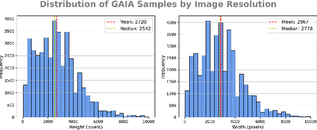
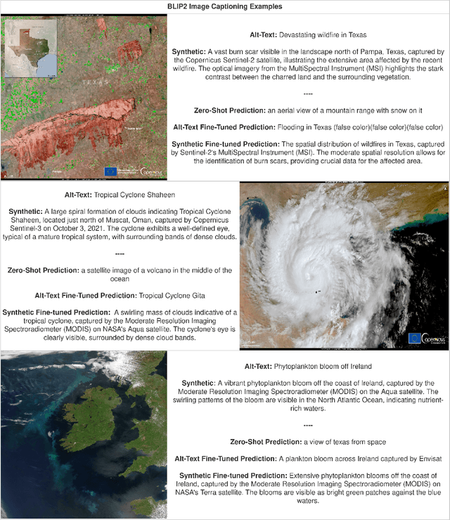
The continuous operation of Earth-orbiting satellites generates vast and ever-growing archives of Remote Sensing (RS) images. Natural language presents an intuitive interface for accessing, querying, and interpreting the data from such archives. However, existing Vision-Language Models (VLMs) are predominantly trained on web-scraped, noisy image-text data, exhibiting limited exposure to the specialized domain of RS. This deficiency results in poor performance on RS-specific tasks, as commonly used datasets often lack detailed, scientifically accurate textual descriptions and instead emphasize solely on attributes like date and location. To bridge this critical gap, we introduce GAIA, a novel dataset designed for multi-scale, multi-sensor, and multi-modal RS image analysis. GAIA comprises of 205,150 meticulously curated RS image-text pairs, representing a diverse range of RS modalities associated to different spatial resolutions. Unlike existing vision-language datasets in RS, GAIA specifically focuses on capturing a diverse range of RS applications, providing unique information about environmental changes, natural disasters, and various other dynamic phenomena. The dataset provides a spatially and temporally balanced distribution, spanning across the globe, covering the last 25 years with a balanced temporal distribution of observations. GAIA's construction involved a two-stage process: (1) targeted web-scraping of images and accompanying text from reputable RS-related sources, and (2) generation of five high-quality, scientifically grounded synthetic captions for each image using carefully crafted prompts that leverage the advanced vision-language capabilities of GPT-4o. Our extensive experiments, including fine-tuning of CLIP and BLIP2 models, demonstrate that GAIA significantly improves performance on RS image classification, cross-modal retrieval and image captioning tasks.