Sébastien Lefevre
Localize to Classify and Classify to Localize: Mutual Guidance in Object Detection
Sep 29, 2020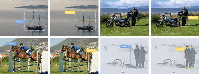
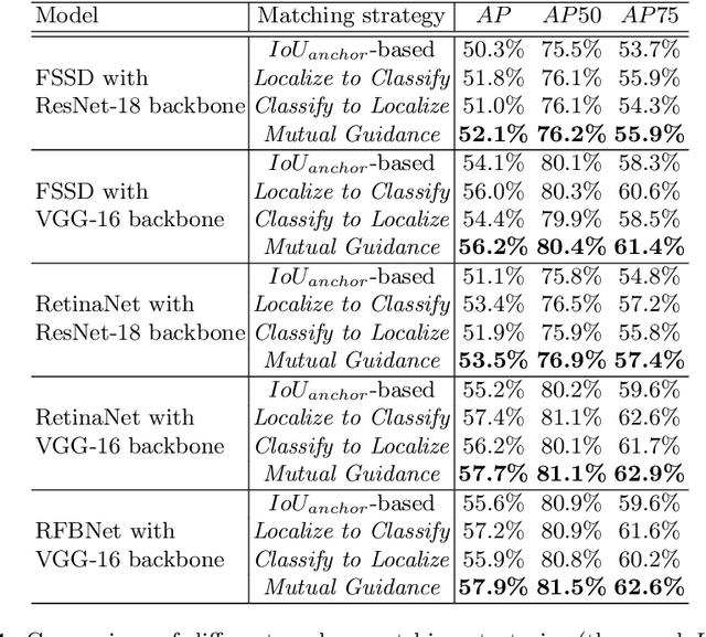
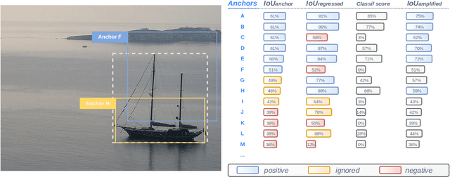
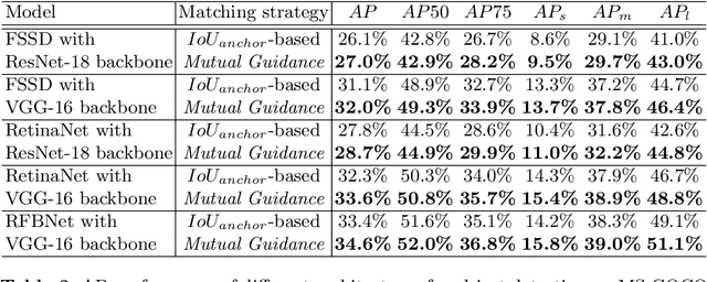
Abstract:Most deep learning object detectors are based on the anchor mechanism and resort to the Intersection over Union (IoU) between predefined anchor boxes and ground truth boxes to evaluate the matching quality between anchors and objects. In this paper, we question this use of IoU and propose a new anchor matching criterion guided, during the training phase, by the optimization of both the localization and the classification tasks: the predictions related to one task are used to dynamically assign sample anchors and improve the model on the other task, and vice versa. Despite the simplicity of the proposed method, our experiments with different state-of-the-art deep learning architectures on PASCAL VOC and MS COCO datasets demonstrate the effectiveness and generality of our Mutual Guidance strategy.
Multispectral Fusion for Object Detection with Cyclic Fuse-and-Refine Blocks
Sep 26, 2020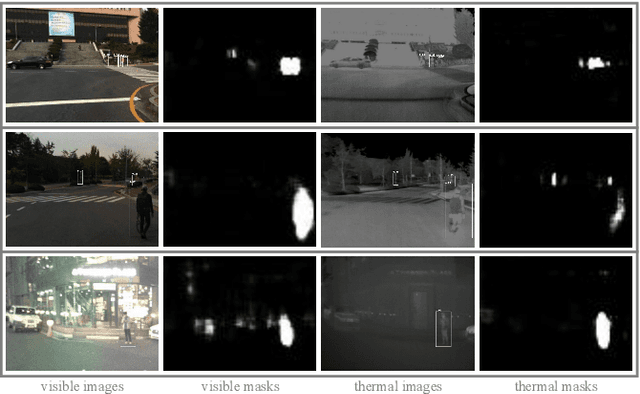
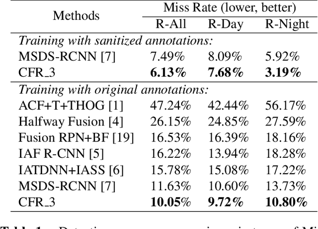


Abstract:Multispectral images (e.g. visible and infrared) may be particularly useful when detecting objects with the same model in different environments (e.g. day/night outdoor scenes). To effectively use the different spectra, the main technical problem resides in the information fusion process. In this paper, we propose a new halfway feature fusion method for neural networks that leverages the complementary/consistency balance existing in multispectral features by adding to the network architecture, a particular module that cyclically fuses and refines each spectral feature. We evaluate the effectiveness of our fusion method on two challenging multispectral datasets for object detection. Our results show that implementing our Cyclic Fuse-and-Refine module in any network improves the performance on both datasets compared to other state-of-the-art multispectral object detection methods.
Combining multiple resolutions into hierarchical representations for kernel-based image classification
Jul 12, 2016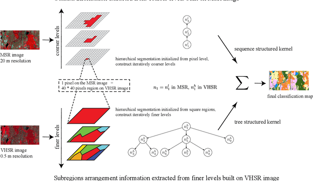
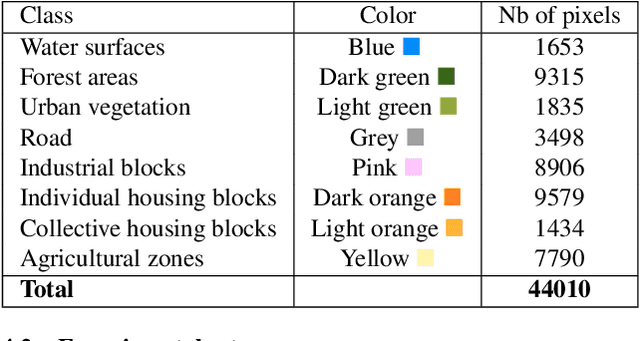
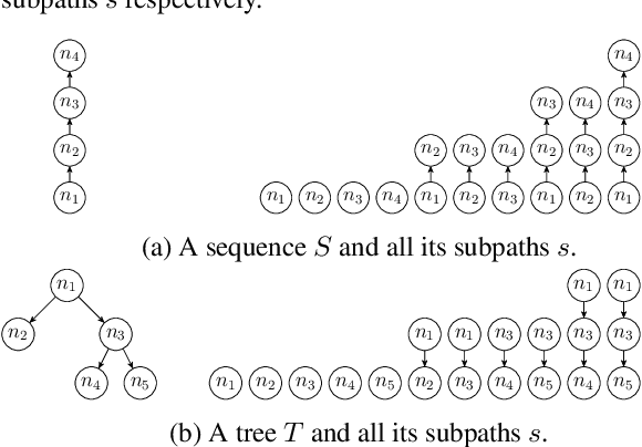
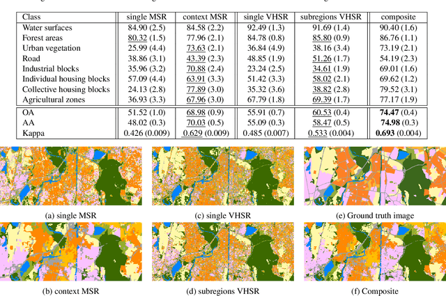
Abstract:Geographic object-based image analysis (GEOBIA) framework has gained increasing interest recently. Following this popular paradigm, we propose a novel multiscale classification approach operating on a hierarchical image representation built from two images at different resolutions. They capture the same scene with different sensors and are naturally fused together through the hierarchical representation, where coarser levels are built from a Low Spatial Resolution (LSR) or Medium Spatial Resolution (MSR) image while finer levels are generated from a High Spatial Resolution (HSR) or Very High Spatial Resolution (VHSR) image. Such a representation allows one to benefit from the context information thanks to the coarser levels, and subregions spatial arrangement information thanks to the finer levels. Two dedicated structured kernels are then used to perform machine learning directly on the constructed hierarchical representation. This strategy overcomes the limits of conventional GEOBIA classification procedures that can handle only one or very few pre-selected scales. Experiments run on an urban classification task show that the proposed approach can highly improve the classification accuracy w.r.t. conventional approaches working on a single scale.
 Add to Chrome
 Add to Firefox
 Add to Edge