Muhammed Sit
EfficientTempNet: Temporal Super-Resolution of Radar Rainfall
Mar 09, 2023Abstract:Rainfall data collected by various remote sensing instruments such as radars or satellites has different space-time resolutions. This study aims to improve the temporal resolution of radar rainfall products to help with more accurate climate change modeling and studies. In this direction, we introduce a solution based on EfficientNetV2, namely EfficientTempNet, to increase the temporal resolution of radar-based rainfall products from 10 minutes to 5 minutes. We tested EfficientRainNet over a dataset for the state of Iowa, US, and compared its performance to three different baselines to show that EfficientTempNet presents a viable option for better climate change monitoring.
DEM Super-Resolution with EfficientNetV2
Sep 20, 2021


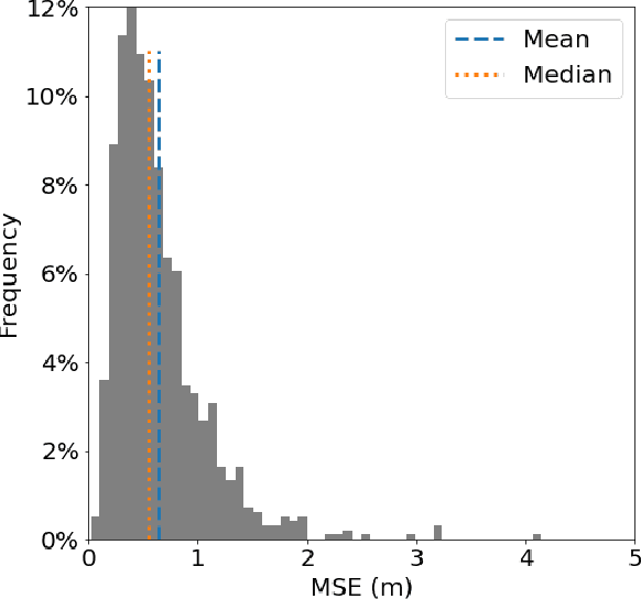
Abstract:Efficient climate change monitoring and modeling rely on high-quality geospatial and environmental datasets. Due to limitations in technical capabilities or resources, the acquisition of high-quality data for many environmental disciplines is costly. Digital Elevation Model (DEM) datasets are such examples whereas their low-resolution versions are widely available, high-resolution ones are scarce. In an effort to rectify this problem, we propose and assess an EfficientNetV2 based model. The proposed model increases the spatial resolution of DEMs up to 16times without additional information.
CNN-based Temporal Super Resolution of Radar Rainfall Products
Sep 20, 2021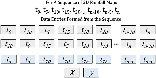

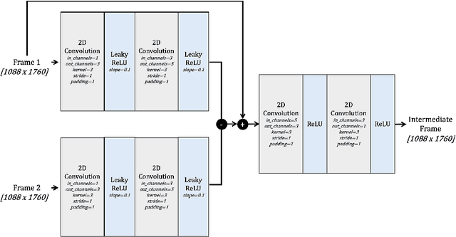
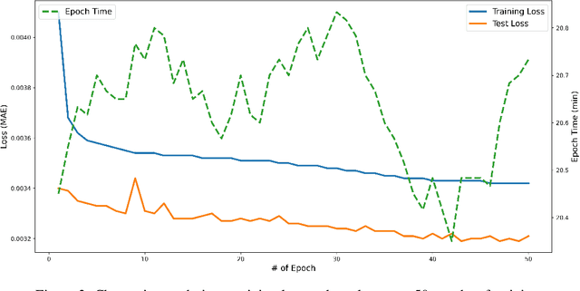
Abstract:The temporal and spatial resolution of rainfall data is crucial for climate change modeling studies in which its variability in space and time is considered as a primary factor. Rainfall products from different remote sensing instruments (e.g., radar or satellite) provide different space-time resolutions because of the differences in their sensing capabilities. We developed an approach that augments rainfall data with increased time resolutions to complement relatively lower resolution products. This study proposes a neural network architecture based on Convolutional Neural Networks (CNNs) to improve temporal resolution of radar-based rainfall products and compares the proposed model with an optical flow-based interpolation method.
Short-term Hourly Streamflow Prediction with Graph Convolutional GRU Networks
Jul 07, 2021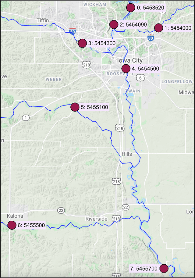

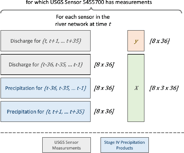

Abstract:The frequency and impact of floods are expected to increase due to climate change. It is crucial to predict streamflow, consequently flooding, in order to prepare and mitigate its consequences in terms of property damage and fatalities. This paper presents a Graph Convolutional GRUs based model to predict the next 36 hours of streamflow for a sensor location using the upstream river network. As shown in experiment results, the model presented in this study provides better performance than the persistence baseline and a Convolutional Bidirectional GRU network for the selected study area in short-term streamflow prediction.
IowaRain: A Statewide Rain Event Dataset Based on Weather Radars and Quantitative Precipitation Estimation
Jul 07, 2021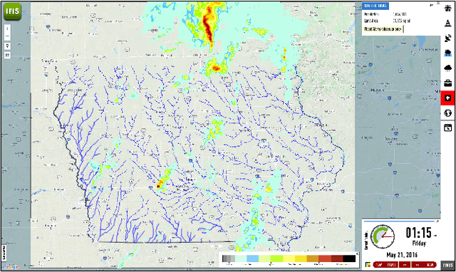


Abstract:Effective environmental planning and management to address climate change could be achieved through extensive environmental modeling with machine learning and conventional physical models. In order to develop and improve these models, practitioners and researchers need comprehensive benchmark datasets that are prepared and processed with environmental expertise that they can rely on. This study presents an extensive dataset of rainfall events for the state of Iowa (2016-2019) acquired from the National Weather Service Next Generation Weather Radar (NEXRAD) system and processed by a quantitative precipitation estimation system. The dataset presented in this study could be used for better disaster monitoring, response and recovery by paving the way for both predictive and prescriptive modeling.
D-SRGAN: DEM Super-Resolution with Generative Adversarial Networks
Apr 16, 2020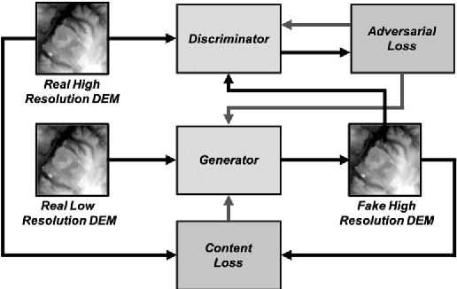
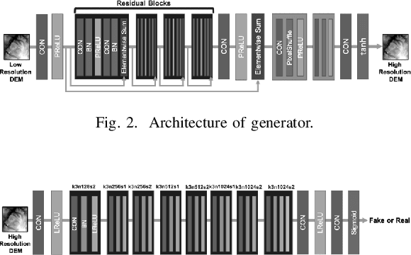
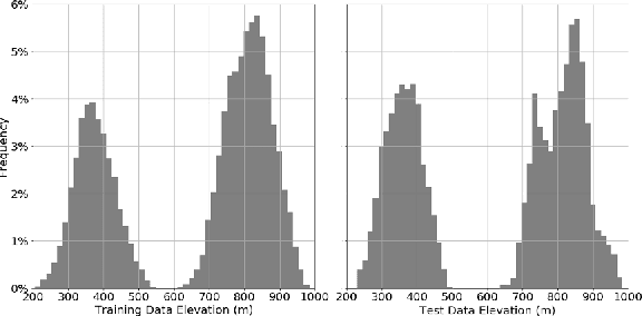

Abstract:LIDAR (light detection and ranging) is an optical remote-sensing technique that measures the distance between sensor and object, and the reflected energy from the object. Over the years, LIDAR data has been used as the primary source of Digital Elevation Models (DEMs). DEMs have been used in a variety of applications like road extraction, hydrological modeling, flood mapping, and surface analysis. A number of studies in flooding suggest the usage of high-resolution DEMs as inputs in the applications improve the overall reliability and accuracy. Despite the importance of high-resolution DEM, many areas in the United States and the world do not have access to high-resolution DEM due to technological limitations or the cost of the data collection. With recent development in Graphical Processing Units (GPU) and novel algorithms, deep learning techniques have become attractive to researchers for their performance in learning features from high-resolution datasets. Numerous new methods have been proposed such as Generative Adversarial Networks (GANs) to create intelligent models that correct and augment large-scale datasets. In this paper, a GAN based model is developed and evaluated, inspired by single image super-resolution methods, to increase the spatial resolution of a given DEM dataset up to 4 times without additional information related to data.
Realistic River Image Synthesis using Deep Generative Adversarial Networks
Mar 03, 2020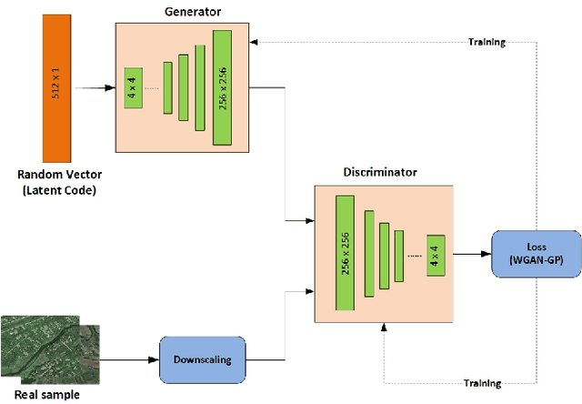

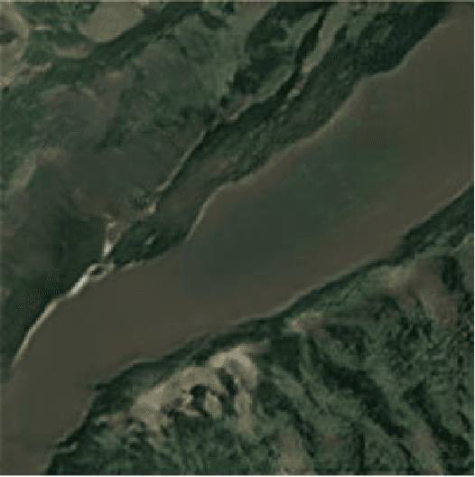
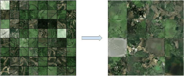
Abstract:In this paper, we investigate an application of image generation for river satellite imagery. Specifically, we propose a generative adversarial network (GAN) model capable of generating high-resolution and realistic river images that can be used to support models in surface water estimation, river meandering, wetland loss and other hydrological research studies. First, we summarized an augmented, diverse repository of overhead river images to be used in training. Second, we incorporate the Progressive Growing GAN (PGGAN), a network architecture that iteratively trains smaller-resolution GANs to gradually build up to a very high resolution, to generate 256x256 river satellite imagery. With conventional GAN architectures, difficulties soon arise in terms of exponential increase of training time and vanishing/exploding gradient issues, which the PGGAN implementation seems to significantly reduce. Our preliminary results show great promise in capturing the detail of river flow and green areas present in river satellite images that can be used for supporting hydroinformatics studies.
Decentralized Flood Forecasting Using Deep Neural Networks
Feb 06, 2019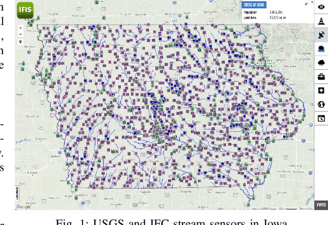
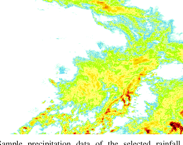

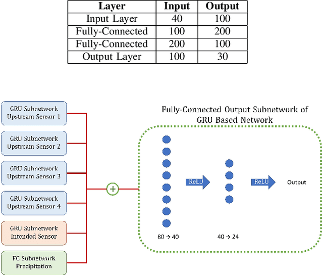
Abstract:Predicting flood for any location at times of extreme storms is a longstanding problem that has utmost importance in emergency management. Conventional methods that aim to predict water levels in streams use advanced hydrological models still lack of giving accurate forecasts everywhere. This study aims to explore artificial deep neural networks' performance on flood prediction. While providing models that can be used in forecasting stream stage, this paper presents a dataset that focuses on the connectivity of data points on river networks. It also shows that neural networks can be very helpful in time-series forecasting as in flood events, and support improving existing models through data assimilation.
 Add to Chrome
 Add to Firefox
 Add to Edge