Jeffrey R. Peters
UAV Surveillance Under Visibility and Dwell-Time Constraints: A Sampling-Based Approach
Aug 08, 2019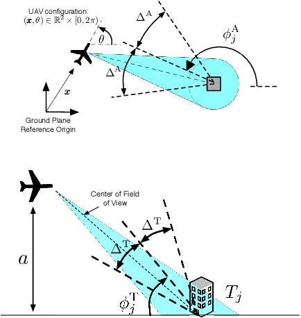

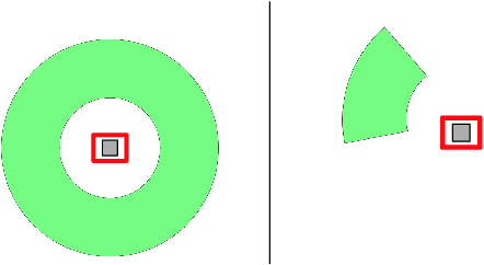
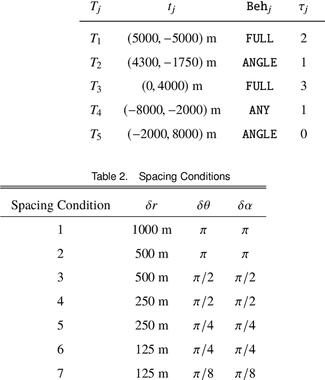
Abstract:A framework is introduced for planning unmanned aerial vehicle flight paths for visual surveillance of ground targets, each having particular viewing requirements. Specifically, each target is associated with a set of imaging parameters, including a desired (i) tilt angle, (ii) azimuth, with the option of a 360-degree view, and (iii) dwell-time. Tours are sought to image the targets, while minimizing both the total mission time and the time required to reach the initial target. An epsilon-constraint scalarization is used to pose the multi-objective problem as a constrained optimization, which, through careful discretization, can be approximated as a discrete graph-search. It is shown that, in many cases, this approximation is equivalent to a generalized traveling salesperson problem. A heuristic procedure for solving the discrete approximation and recovering solutions to the full routing problem is presented, and is shown to have resolution completeness properties. Algorithms are illustrated through numerical studies.
Asynchronous and Dynamic Coverage Control Scheme for Persistent Surveillance Missions
Feb 15, 2017
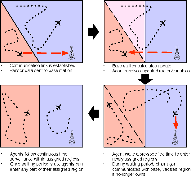
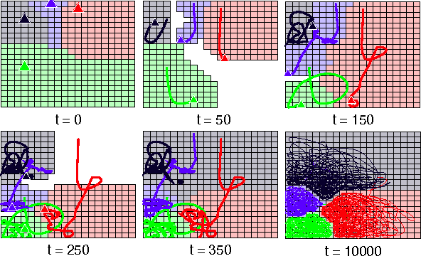

Abstract:A decomposition-based coverage control scheme is proposed for multi-agent, persistent surveillance missions operating in a communication-constrained, dynamic environment. The proposed approach decouples high-level task assignment from low-level motion planning in a modular framework. Coverage assignments and surveillance parameters are managed by a central base station, and transmitted to mobile agents via unplanned and asynchronous exchanges. Coverage updates promote load balancing, while maintaining geometric and temporal characteristics that allow effective pairing with generic path planners. Namely, the proposed scheme guarantees that (i) coverage regions are connected and collectively cover the environment, (ii) subregions may only go uncovered for bounded periods of time, (iii) collisions (or sensing overlaps) are inherently avoided, and (iv) under static event likelihoods, the collective coverage regions converge to a Pareto-optimal configuration. This management scheme is then paired with a generic path planner satisfying loose assumptions. The scheme is illustrated through simulated surveillance missions.
 Add to Chrome
 Add to Firefox
 Add to Edge