UAV Surveillance Under Visibility and Dwell-Time Constraints: A Sampling-Based Approach
Paper and Code
Aug 08, 2019


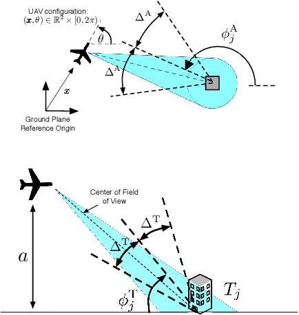
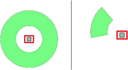
A framework is introduced for planning unmanned aerial vehicle flight paths for visual surveillance of ground targets, each having particular viewing requirements. Specifically, each target is associated with a set of imaging parameters, including a desired (i) tilt angle, (ii) azimuth, with the option of a 360-degree view, and (iii) dwell-time. Tours are sought to image the targets, while minimizing both the total mission time and the time required to reach the initial target. An epsilon-constraint scalarization is used to pose the multi-objective problem as a constrained optimization, which, through careful discretization, can be approximated as a discrete graph-search. It is shown that, in many cases, this approximation is equivalent to a generalized traveling salesperson problem. A heuristic procedure for solving the discrete approximation and recovering solutions to the full routing problem is presented, and is shown to have resolution completeness properties. Algorithms are illustrated through numerical studies.
 Add to Chrome
 Add to Firefox
 Add to Edge