Hermawan Mulyono
SafeSea: Synthetic Data Generation for Adverse & Low Probability Maritime Conditions
Nov 24, 2023


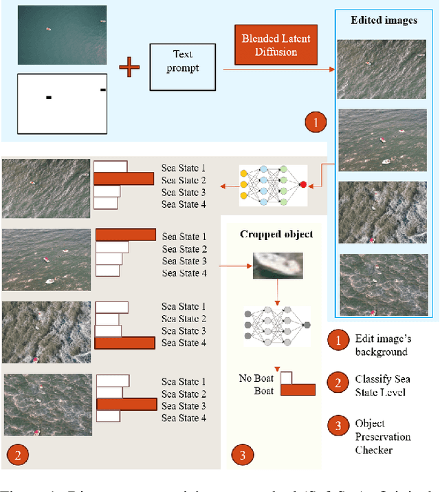
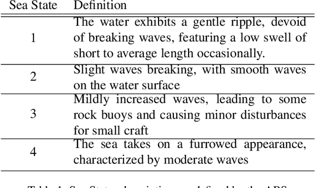
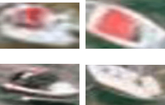
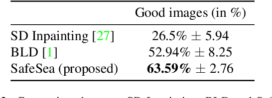
Abstract:High-quality training data is essential for enhancing the robustness of object detection models. Within the maritime domain, obtaining a diverse real image dataset is particularly challenging due to the difficulty of capturing sea images with the presence of maritime objects , especially in stormy conditions. These challenges arise due to resource limitations, in addition to the unpredictable appearance of maritime objects. Nevertheless, acquiring data from stormy conditions is essential for training effective maritime detection models, particularly for search and rescue, where real-world conditions can be unpredictable. In this work, we introduce SafeSea, which is a stepping stone towards transforming actual sea images with various Sea State backgrounds while retaining maritime objects. Compared to existing generative methods such as Stable Diffusion Inpainting~\cite{stableDiffusion}, this approach reduces the time and effort required to create synthetic datasets for training maritime object detection models. The proposed method uses two automated filters to only pass generated images that meet the criteria. In particular, these filters will first classify the sea condition according to its Sea State level and then it will check whether the objects from the input image are still preserved. This method enabled the creation of the SafeSea dataset, offering diverse weather condition backgrounds to supplement the training of maritime models. Lastly, we observed that a maritime object detection model faced challenges in detecting objects in stormy sea backgrounds, emphasizing the impact of weather conditions on detection accuracy. The code, and dataset are available at https://github.com/martin-3240/SafeSea.
RtFPS: An Interactive Map that Visualizes and Predicts Wildfires in the US
May 23, 2021


Abstract:Climate change has largely impacted our daily lives. As one of its consequences, we are experiencing more wildfires. In the year 2020, wildfires burned a record number of 8,888,297 acres in the US. To awaken people's attention to climate change, and to visualize the current risk of wildfires, We developed RtFPS, "Real-Time Fire Prediction System". It provides a real-time prediction visualization of wildfire risk at specific locations base on a Machine Learning model. It also provides interactive map features that show the historical wildfire events with environmental info.
 Add to Chrome
 Add to Firefox
 Add to Edge