Carl Elkin
Satellite Sunroof: High-res Digital Surface Models and Roof Segmentation for Global Solar Mapping
Aug 26, 2024


Abstract:The transition to renewable energy, particularly solar, is key to mitigating climate change. Google's Solar API aids this transition by estimating solar potential from aerial imagery, but its impact is constrained by geographical coverage. This paper proposes expanding the API's reach using satellite imagery, enabling global solar potential assessment. We tackle challenges involved in building a Digital Surface Model (DSM) and roof instance segmentation from lower resolution and single oblique views using deep learning models. Our models, trained on aligned satellite and aerial datasets, produce 25cm DSMs and roof segments. With ~1m DSM MAE on buildings, ~5deg roof pitch error and ~56% IOU on roof segmentation, they significantly enhance the Solar API's potential to promote solar adoption.
Estimating Residential Solar Potential Using Aerial Data
Jun 23, 2023


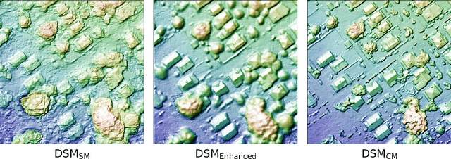
Abstract:Project Sunroof estimates the solar potential of residential buildings using high quality aerial data. That is, it estimates the potential solar energy (and associated financial savings) that can be captured by buildings if solar panels were to be installed on their roofs. Unfortunately its coverage is limited by the lack of high resolution digital surface map (DSM) data. We present a deep learning approach that bridges this gap by enhancing widely available low-resolution data, thereby dramatically increasing the coverage of Sunroof. We also present some ongoing efforts to potentially improve accuracy even further by replacing certain algorithmic components of the Sunroof processing pipeline with deep learning.
 Add to Chrome
 Add to Firefox
 Add to Edge