Blake Regalia
SE-KGE: A Location-Aware Knowledge Graph Embedding Model for Geographic Question Answering and Spatial Semantic Lifting
Apr 25, 2020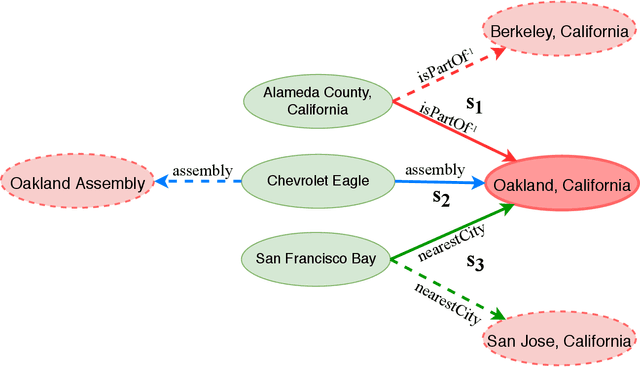
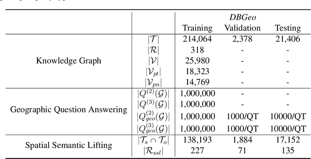
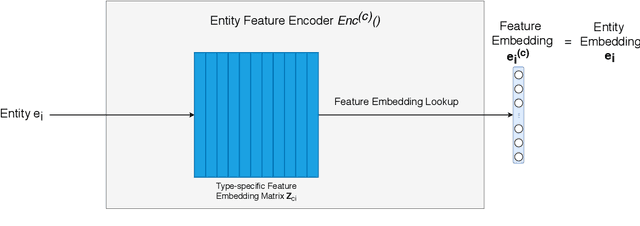
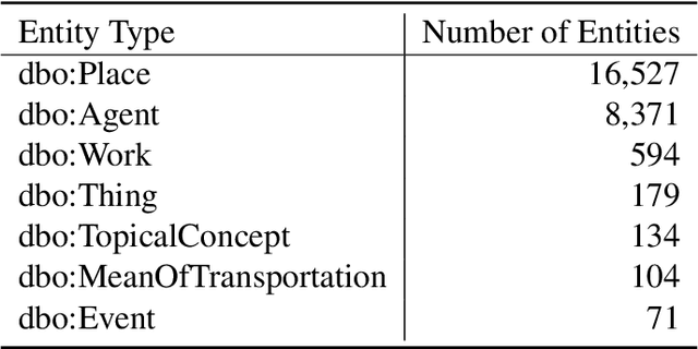
Abstract:Learning knowledge graph (KG) embeddings is an emerging technique for a variety of downstream tasks such as summarization, link prediction, information retrieval, and question answering. However, most existing KG embedding models neglect space and, therefore, do not perform well when applied to (geo)spatial data and tasks. For those models that consider space, most of them primarily rely on some notions of distance. These models suffer from higher computational complexity during training while still losing information beyond the relative distance between entities. In this work, we propose a location-aware KG embedding model called SE-KGE. It directly encodes spatial information such as point coordinates or bounding boxes of geographic entities into the KG embedding space. The resulting model is capable of handling different types of spatial reasoning. We also construct a geographic knowledge graph as well as a set of geographic query-answer pairs called DBGeo to evaluate the performance of SE-KGE in comparison to multiple baselines. Evaluation results show that SE-KGE outperforms these baselines on the DBGeo dataset for geographic logic query answering task. This demonstrates the effectiveness of our spatially-explicit model and the importance of considering the scale of different geographic entities. Finally, we introduce a novel downstream task called spatial semantic lifting which links an arbitrary location in the study area to entities in the KG via some relations. Evaluation on DBGeo shows that our model outperforms the baseline by a substantial margin.
* Accepted to Transactions in GIS
Semantically-Enriched Search Engine for Geoportals: A Case Study with ArcGIS Online
Mar 14, 2020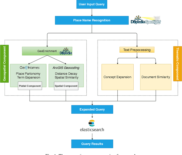


Abstract:Many geoportals such as ArcGIS Online are established with the goal of improving geospatial data reusability and achieving intelligent knowledge discovery. However, according to previous research, most of the existing geoportals adopt Lucene-based techniques to achieve their core search functionality, which has a limited ability to capture the user's search intentions. To better understand a user's search intention, query expansion can be used to enrich the user's query by adding semantically similar terms. In the context of geoportals and geographic information retrieval, we advocate the idea of semantically enriching a user's query from both geospatial and thematic perspectives. In the geospatial aspect, we propose to enrich a query by using both place partonomy and distance decay. In terms of the thematic aspect, concept expansion and embedding-based document similarity are used to infer the implicit information hidden in a user's query. This semantic query expansion 1 2 G. Mai et al. framework is implemented as a semantically-enriched search engine using ArcGIS Online as a case study. A benchmark dataset is constructed to evaluate the proposed framework. Our evaluation results show that the proposed semantic query expansion framework is very effective in capturing a user's search intention and significantly outperforms a well-established baseline-Lucene's practical scoring function-with more than 3.0 increments in DCG@K (K=3,5,10).
* 18 pages; Accepted to AGILE 2020 as a full paper GitHub Code Repository: https://github.com/gengchenmai/arcgis-online-search-engine
 Add to Chrome
 Add to Firefox
 Add to Edge