Antonio Mazza
A Feasibility Study on Opportunistic Rainfall Measurement From Satellite TV Broadcasts
Mar 08, 2023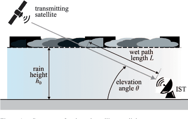
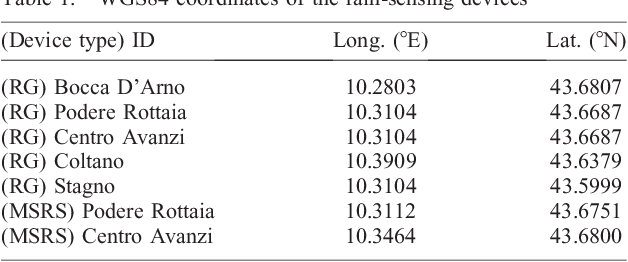

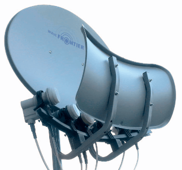
Abstract:Rainfall precipitation maps are usually derived based on the measurements collected by classical weather devices, such as rain gauges and weather stations. This article aims to show the benefits obtained by opportunistic rainfall measurements based on signal strength measurements provided by commercial-grade satellite terminals (e.g., used in TV broadcasting). To assess not only the feasibility of this approach, with significant advantages in terms of capital and operational expenditure, but also improvements in terms of accuracy, we focus on a case study for agricultural applications using a Gaussian-modeled synthetic rain over a specific, real-world test area.
* 5 pages, 7 figures
Pansharpening by convolutional neural networks in the full resolution framework
Nov 16, 2021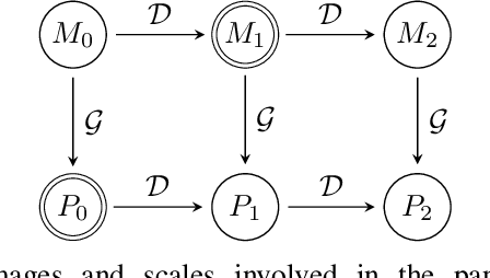
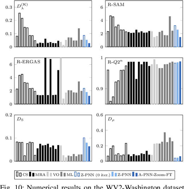
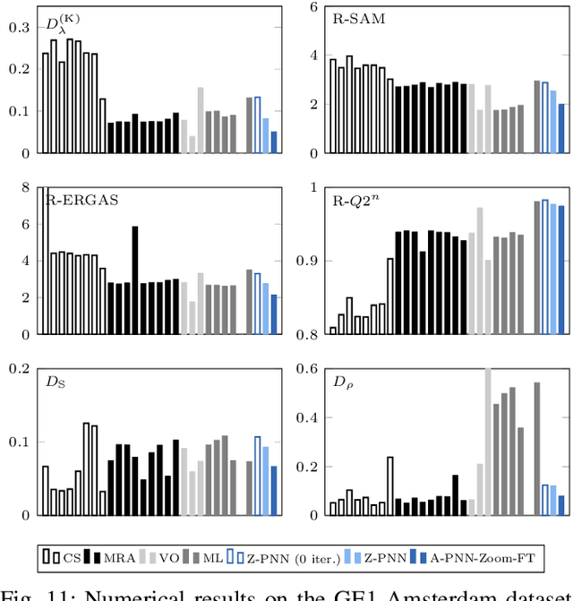
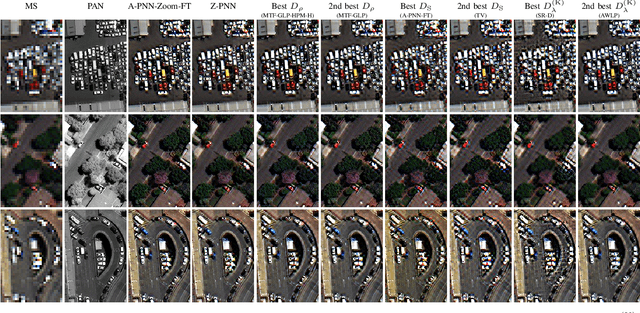
Abstract:In recent years, there has been a growing interest on deep learning-based pansharpening. Research has mainly focused on architectures. However, lacking a ground truth, model training is also a major issue. A popular approach is to train networks in a reduced resolution domain, using the original data as ground truths. The trained networks are then used on full resolution data, relying on an implicit scale invariance hypothesis. Results are generally good at reduced resolution, but more questionable at full resolution. Here, we propose a full-resolution training framework for deep learning-based pansharpening. Training takes place in the high resolution domain, relying only on the original data, with no loss of information. To ensure spectral and spatial fidelity, suitable losses are defined, which force the pansharpened output to be consistent with the available panchromatic and multispectral input. Experiments carried out on WorldView-3, WorldView-2, and GeoEye-1 images show that methods trained with the proposed framework guarantee an excellent performance in terms of both full-resolution numerical indexes and visual quality. The framework is fully general, and can be used to train and fine-tune any deep learning-based pansharpening network.
Deep Learning Solutions for TanDEM-X-based Forest Classification
Feb 01, 2019
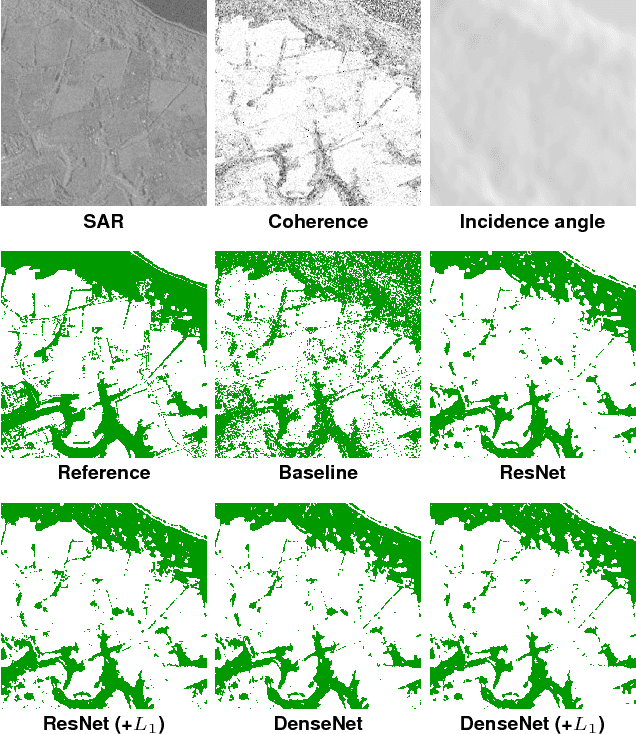
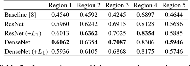
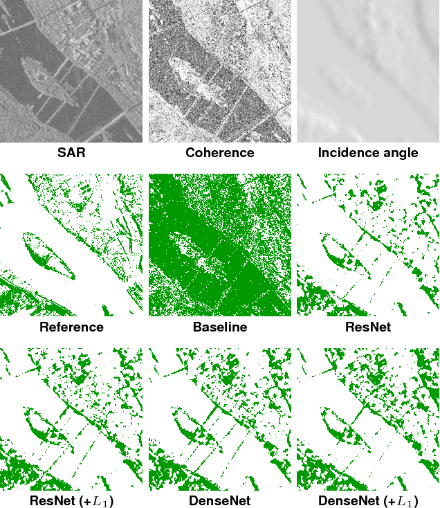
Abstract:In the last few years, deep learning (DL) has been successfully and massively employed in computer vision for discriminative tasks, such as image classification or object detection. This kind of problems are core to many remote sensing (RS) applications as well, though with domain-specific peculiarities. Therefore, there is a growing interest on the use of DL methods for RS tasks. Here, we consider the forest/non-forest classification problem with TanDEM-X data, and test two state-of-the-art DL models, suitably adapting them to the specific task. Our experiments confirm the great potential of DL methods for RS applications.
 Add to Chrome
 Add to Firefox
 Add to Edge