WorldKG: A World-Scale Geographic Knowledge Graph
Paper and Code
Sep 21, 2021


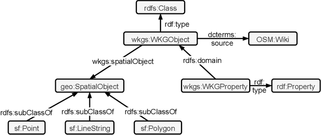
OpenStreetMap is a rich source of openly available geographic information. However, the representation of geographic entities, e.g., buildings, mountains, and cities, within OpenStreetMap is highly heterogeneous, diverse, and incomplete. As a result, this rich data source is hardly usable for real-world applications. This paper presents WorldKG -- a new geographic knowledge graph aiming to provide a comprehensive semantic representation of geographic entities in OpenStreetMap. We describe the WorldKG knowledge graph, including its ontology that builds the semantic dataset backbone, the extraction procedure of the ontology and geographic entities from OpenStreetMap, and the methods to enhance entity annotation. We perform statistical and qualitative dataset assessment, demonstrating the large scale and high precision of the semantic geographic information in WorldKG.
 Add to Chrome
 Add to Firefox
 Add to Edge