Self-consistent Deep Geometric Learning for Heterogeneous Multi-source Spatial Point Data Prediction
Paper and Code
Jun 30, 2024


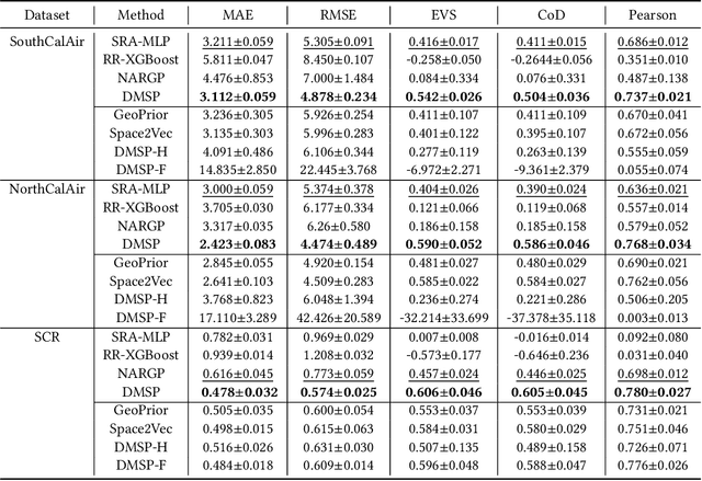
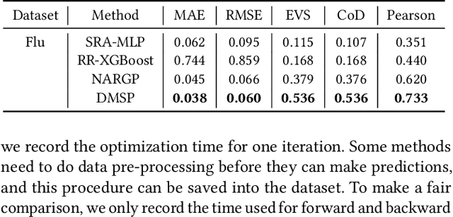
Multi-source spatial point data prediction is crucial in fields like environmental monitoring and natural resource management, where integrating data from various sensors is the key to achieving a holistic environmental understanding. Existing models in this area often fall short due to their domain-specific nature and lack a strategy for integrating information from various sources in the absence of ground truth labels. Key challenges include evaluating the quality of different data sources and modeling spatial relationships among them effectively. Addressing these issues, we introduce an innovative multi-source spatial point data prediction framework that adeptly aligns information from varied sources without relying on ground truth labels. A unique aspect of our method is the 'fidelity score,' a quantitative measure for evaluating the reliability of each data source. Furthermore, we develop a geo-location-aware graph neural network tailored to accurately depict spatial relationships between data points. Our framework has been rigorously tested on two real-world datasets and one synthetic dataset. The results consistently demonstrate its superior performance over existing state-of-the-art methods.
 Add to Chrome
 Add to Firefox
 Add to Edge