MuSCLE: Multi Sweep Compression of LiDAR using Deep Entropy Models
Paper and Code
Nov 15, 2020


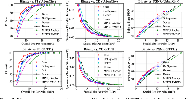
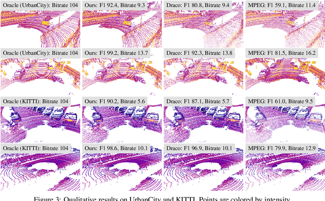
We present a novel compression algorithm for reducing the storage of LiDAR sensor data streams. Our model exploits spatio-temporal relationships across multiple LiDAR sweeps to reduce the bitrate of both geometry and intensity values. Towards this goal, we propose a novel conditional entropy model that models the probabilities of the octree symbols by considering both coarse level geometry and previous sweeps' geometric and intensity information. We then use the learned probability to encode the full data stream into a compact one. Our experiments demonstrate that our method significantly reduces the joint geometry and intensity bitrate over prior state-of-the-art LiDAR compression methods, with a reduction of 7-17% and 15-35% on the UrbanCity and SemanticKITTI datasets respectively.
 Add to Chrome
 Add to Firefox
 Add to Edge