 Add to Chrome
 Add to Firefox
 Add to Edge
Leveraging Semantic Graphs for Efficient and Robust LiDAR SLAM
Paper and Code
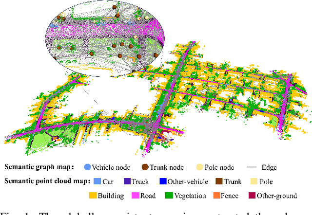
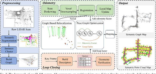
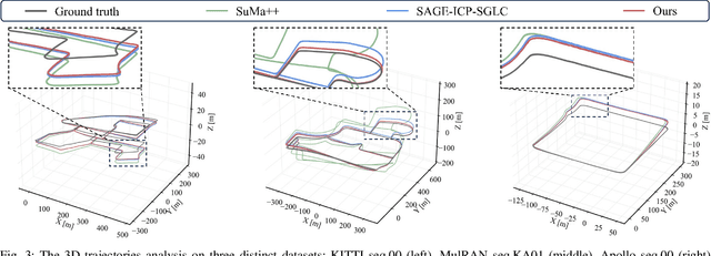
Accurate and robust simultaneous localization and mapping (SLAM) is crucial for autonomous mobile systems, typically achieved by leveraging the geometric features of the environment. Incorporating semantics provides a richer scene representation that not only enhances localization accuracy in SLAM but also enables advanced cognitive functionalities for downstream navigation and planning tasks. Existing point-wise semantic LiDAR SLAM methods often suffer from poor efficiency and generalization, making them less robust in diverse real-world scenarios. In this paper, we propose a semantic graph-enhanced SLAM framework, named SG-SLAM, which effectively leverages the geometric, semantic, and topological characteristics inherent in environmental structures. The semantic graph serves as a fundamental component that facilitates critical functionalities of SLAM, including robust relocalization during odometry failures, accurate loop closing, and semantic graph map construction. Our method employs a dual-threaded architecture, with one thread dedicated to online odometry and relocalization, while the other handles loop closure, pose graph optimization, and map update. This design enables our method to operate in real time and generate globally consistent semantic graph maps and point cloud maps. We extensively evaluate our method across the KITTI, MulRAN, and Apollo datasets, and the results demonstrate its superiority compared to state-of-the-art methods. Our method has been released at https://github.com/nubot-nudt/SG-SLAM.