Energy-Efficient SLAM via Joint Design of Sensing, Communication, and Exploration Speed
Paper and Code
Dec 18, 2024


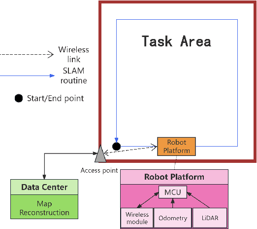
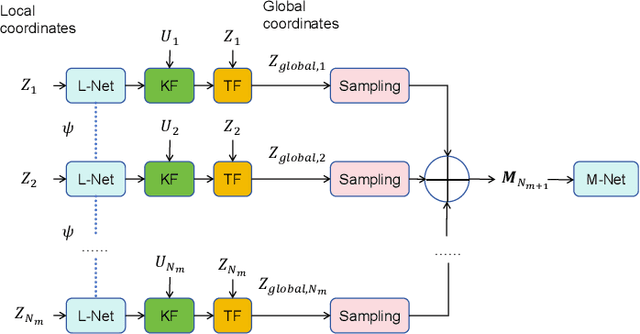
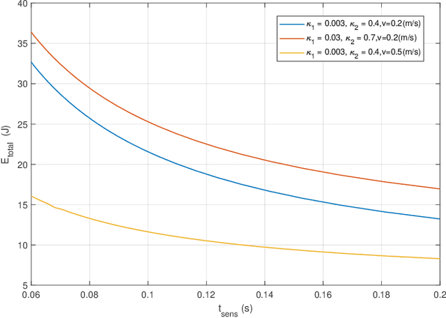
To support future spatial machine intelligence applications, lifelong simultaneous localization and mapping (SLAM) has drawn significant attentions. SLAM is usually realized based on various types of mobile robots performing simultaneous and continuous sensing and communication. This paper focuses on analyzing the energy efficiency of robot operation for lifelong SLAM by jointly considering sensing, communication and mechanical factors. The system model is built based on a robot equipped with a 2D light detection and ranging (LiDAR) and an odometry. The cloud point raw data as well as the odometry data are wirelessly transmitted to data center where real-time map reconstruction is realized based on an unsupervised deep learning based method. The sensing duration, transmit power, transmit duration and exploration speed are jointly optimized to minimize the energy consumption. Simulations and experiments demonstrate the performance of our proposed method.
 Add to Chrome
 Add to Firefox
 Add to Edge