Combining Photogrammetric Computer Vision and Semantic Segmentation for Fine-grained Understanding of Coral Reef Growth under Climate Change
Paper and Code
Dec 08, 2022


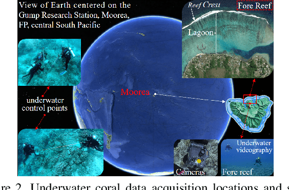
Corals are the primary habitat-building life-form on reefs that support a quarter of the species in the ocean. A coral reef ecosystem usually consists of reefs, each of which is like a tall building in any city. These reef-building corals secrete hard calcareous exoskeletons that give them structural rigidity, and are also a prerequisite for our accurate 3D modeling and semantic mapping using advanced photogrammetric computer vision and machine learning. Underwater videography as a modern underwater remote sensing tool is a high-resolution coral habitat survey and mapping technique. In this paper, detailed 3D mesh models, digital surface models and orthophotos of the coral habitat are generated from the collected coral images and underwater control points. Meanwhile, a novel pixel-wise semantic segmentation approach of orthophotos is performed by advanced deep learning. Finally, the semantic map is mapped into 3D space. For the first time, 3D fine-grained semantic modeling and rugosity evaluation of coral reefs have been completed at millimeter (mm) accuracy. This provides a new and powerful method for understanding the processes and characteristics of coral reef change at high spatial and temporal resolution under climate change.
 Add to Chrome
 Add to Firefox
 Add to Edge