Victor Sundermann
Do Superpixel Segmentation Methods Influence Deforestation Image Classification?
Oct 06, 2025
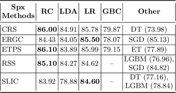
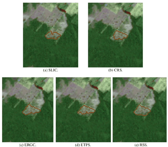
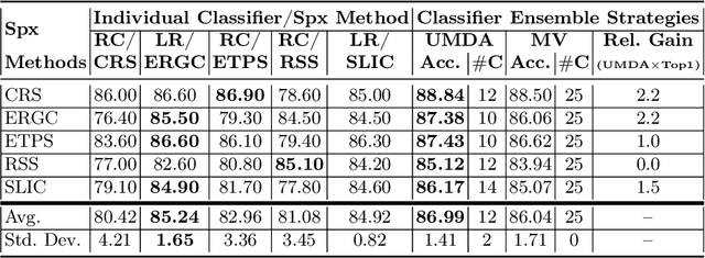
Abstract:Image segmentation is a crucial step in various visual applications, including environmental monitoring through remote sensing. In the context of the ForestEyes project, which combines citizen science and machine learning to detect deforestation in tropical forests, image segments are used for labeling by volunteers and subsequent model training. Traditionally, the Simple Linear Iterative Clustering (SLIC) algorithm is adopted as the segmentation method. However, recent studies have indicated that other superpixel-based methods outperform SLIC in remote sensing image segmentation, and might suggest that they are more suitable for the task of detecting deforested areas. In this sense, this study investigated the impact of the four best segmentation methods, together with SLIC, on the training of classifiers for the target application. Initially, the results showed little variation in performance among segmentation methods, even when selecting the top five classifiers using the PyCaret AutoML library. However, by applying a classifier fusion approach (ensemble of classifiers), noticeable improvements in balanced accuracy were observed, highlighting the importance of both the choice of segmentation method and the combination of machine learning-based models for deforestation detection tasks.
Exploring Superpixel Segmentation Methods in the Context of Citizen Science and Deforestation Detection
Nov 26, 2024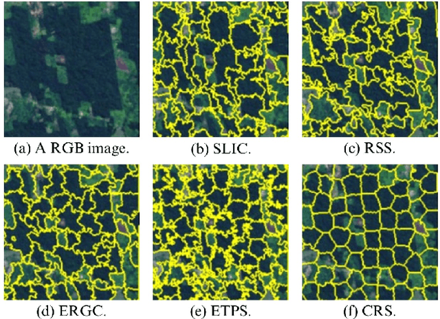
Abstract:Tropical forests play an essential role in the planet's ecosystem, making the conservation of these biomes a worldwide priority. However, ongoing deforestation and degradation pose a significant threat to their existence, necessitating effective monitoring and the proposal of actions to mitigate the damage caused by these processes. In this regard, initiatives range from government and private sector monitoring programs to solutions based on citizen science campaigns, for example. Particularly in the context of citizen science campaigns, the segmentation of remote sensing images to identify deforested areas and subsequently submit them to analysis by non-specialized volunteers is necessary. Thus, segmentation using superpixel-based techniques proves to be a viable solution for this important task. Therefore, this paper presents an analysis of 22 superpixel-based segmentation methods applied to remote sensing images, aiming to identify which of them are more suitable for generating segments for citizen science campaigns. The results reveal that seven of the segmentation methods outperformed the baseline method (SLIC) currently employed in the ForestEyes citizen science project, indicating an opportunity for improvement in this important stage of campaign development.
How to Identify Good Superpixels for Deforestation Detection on Tropical Rainforests
Sep 06, 2024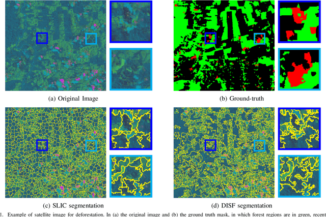
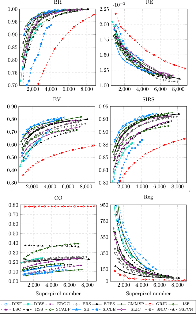
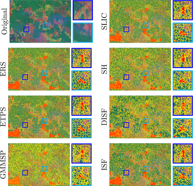
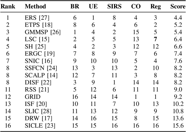
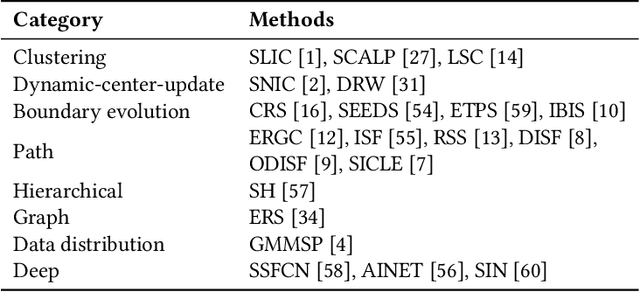
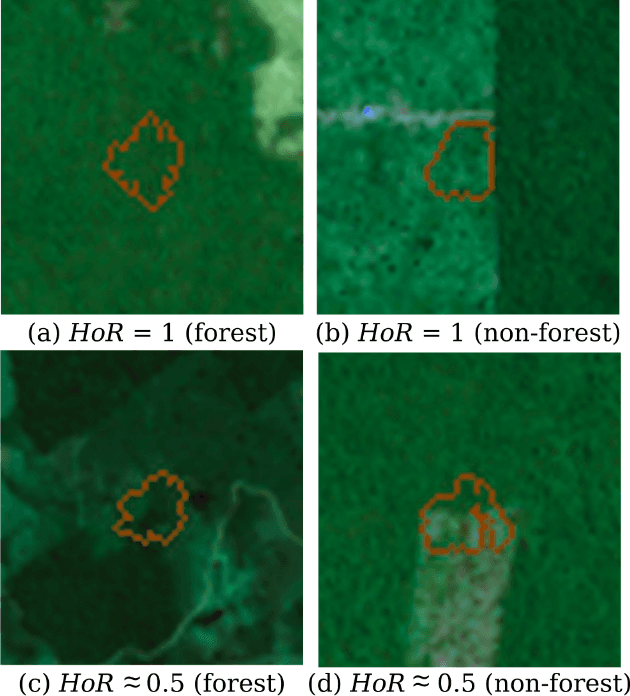
Abstract:The conservation of tropical forests is a topic of significant social and ecological relevance due to their crucial role in the global ecosystem. Unfortunately, deforestation and degradation impact millions of hectares annually, requiring government or private initiatives for effective forest monitoring. However, identifying deforested regions in satellite images is challenging due to data imbalance, image resolution, low-contrast regions, and occlusion. Superpixel segmentation can overcome these drawbacks, reducing workload and preserving important image boundaries. However, most works for remote sensing images do not exploit recent superpixel methods. In this work, we evaluate 16 superpixel methods in satellite images to support a deforestation detection system in tropical forests. We also assess the performance of superpixel methods for the target task, establishing a relationship with segmentation methodological evaluation. According to our results, ERS, GMMSP, and DISF perform best on UE, BR, and SIRS, respectively, whereas ERS has the best trade-off with CO and Reg. In classification, SH, DISF, and ISF perform best on RGB, UMDA, and PCA compositions, respectively. According to our experiments, superpixel methods with better trade-offs between delineation, homogeneity, compactness, and regularity are more suitable for identifying good superpixels for deforestation detection tasks.
 Add to Chrome
 Add to Firefox
 Add to Edge