Tom Avrech
GoToNet: Fast Monocular Scene Exposure and Exploration
Jun 13, 2022


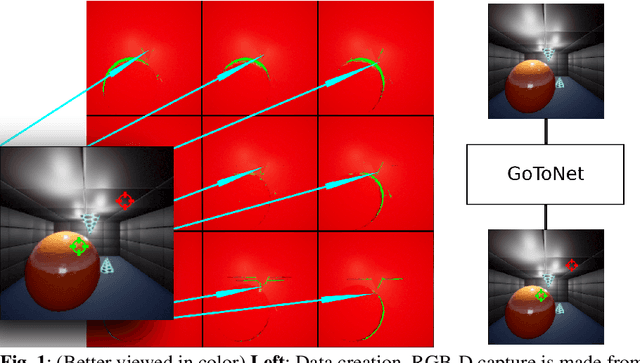
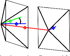
Abstract:Autonomous scene exposure and exploration, especially in localization or communication-denied areas, useful for finding targets in unknown scenes, remains a challenging problem in computer navigation. In this work, we present a novel method for real-time environment exploration, whose only requirements are a visually similar dataset for pre-training, enough lighting in the scene, and an on-board forward-looking RGB camera for environmental sensing. As opposed to existing methods, our method requires only one look (image) to make a good tactical decision, and therefore works at a non-growing, constant time. Two direction predictions, characterized by pixels dubbed the Goto and Lookat pixels, comprise the core of our method. These pixels encode the recommended flight instructions in the following way: the Goto pixel defines the direction in which the agent should move by one distance unit, and the Lookat pixel defines the direction in which the camera should be pointing at in the next step. These flying-instruction pixels are optimized to expose the largest amount of currently unexplored areas. Our method presents a novel deep learning-based navigation approach that is able to solve this problem and demonstrate its ability in an even more complicated setup, i.e., when computational power is limited. In addition, we propose a way to generate a navigation-oriented dataset, enabling efficient training of our method using RGB and depth images. Tests conducted in a simulator evaluating both the sparse pixels' coordinations inferring process, and 2D and 3D test flights aimed to unveil areas and decrease distances to targets achieve promising results. Comparison against a state-of-the-art algorithm shows our method is able to overperform it, that while measuring the new voxels per camera pose, minimum distance to target, percentage of surface voxels seen, and compute time metrics.
 Add to Chrome
 Add to Firefox
 Add to Edge