Srinidhi K. Srinivas
Occlusion-Aware 2D and 3D Centerline Detection for Urban Driving via Automatic Label Generation
Nov 03, 2023


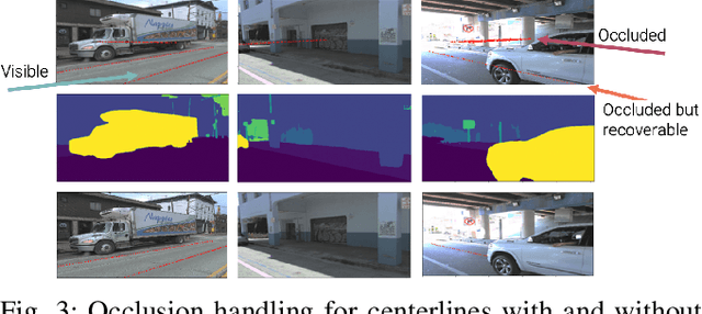
Abstract:This research work seeks to explore and identify strategies that can determine road topology information in 2D and 3D under highly dynamic urban driving scenarios. To facilitate this exploration, we introduce a substantial dataset comprising nearly one million automatically labeled data frames. A key contribution of our research lies in developing an automatic label-generation process and an occlusion handling strategy. This strategy is designed to model a wide range of occlusion scenarios, from mild disruptions to severe blockages. Furthermore, we present a comprehensive ablation study wherein multiple centerline detection methods are developed and evaluated. This analysis not only benchmarks the performance of various approaches but also provides valuable insights into the interpretability of these methods. Finally, we demonstrate the practicality of our methods and assess their adaptability across different sensor configurations, highlighting their versatility and relevance in real-world scenarios. Our dataset and experimental models are publicly available.
 Add to Chrome
 Add to Firefox
 Add to Edge