Serge Hoogendoorn
Crowd Safety Manager: Towards Data-Driven Active Decision Support for Planning and Control of Crowd Events
Jul 31, 2023Abstract:This paper presents novel technology and methodology aimed at enhancing crowd management in both the planning and operational phases. The approach encompasses innovative data collection techniques, data integration, and visualization using a 3D Digital Twin, along with the incorporation of artificial intelligence (AI) tools for risk identification. The paper introduces the Bowtie model, a comprehensive framework designed to assess and predict risk levels. The model combines objective estimations and predictions, such as traffic flow operations and crowdedness levels, with various aggravating factors like weather conditions, sentiments, and the purpose of visitors, to evaluate the expected risk of incidents. The proposed framework is applied to the Crowd Safety Manager project in Scheveningen, where the DigiTwin is developed based on a wealth of real-time data sources. One noteworthy data source is Resono, offering insights into the number of visitors and their movements, leveraging a mobile phone panel of over 2 million users in the Netherlands. Particular attention is given to the left-hand side of the Bowtie, which includes state estimation, prediction, and forecasting. Notably, the focus is on generating multi-day ahead forecasts for event-planning purposes using Resono data. Advanced machine learning techniques, including the XGBoost framework, are compared, with XGBoost demonstrating the most accurate forecasts. The results indicate that the predictions are adequately accurate. However, certain locations may benefit from additional input data to further enhance prediction quality. Despite these limitations, this work contributes to a more effective crowd management system and opens avenues for further advancements in this critical field.
Framework for Network-Constrained Target Tracking
Mar 02, 2022


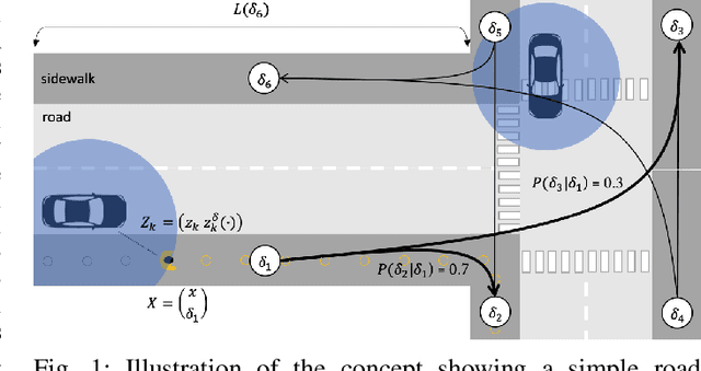
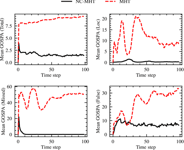
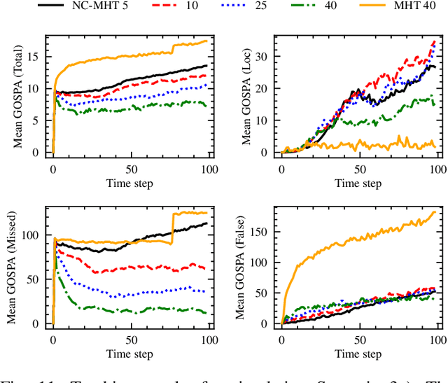
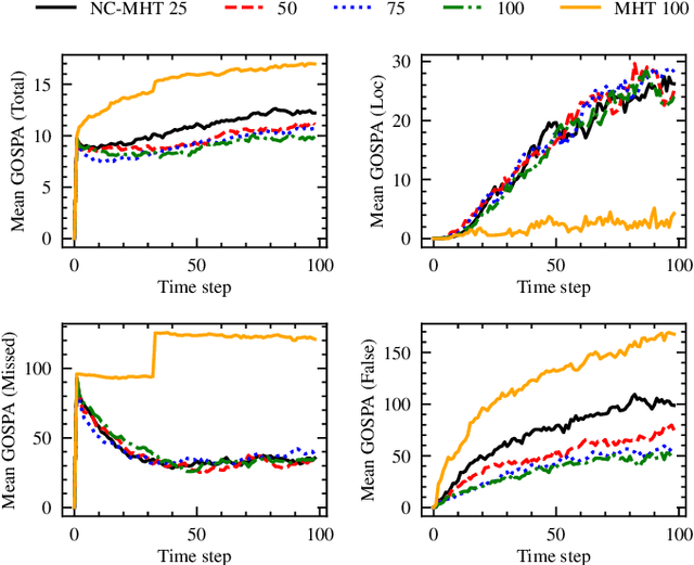
Abstract:The increase in perception capabilities of connected mobile sensor platforms (e.g., self-driving vehicles, drones, and robots) leads to an extensive surge of sensed features at various temporal and spatial scales. Beyond their traditional use for safe operation, available observations could enable to see how and where people move on sidewalks and cycle paths, to eventually obtain a complete microscopic and macroscopic picture of the traffic flows in a larger area. This paper proposes a new method for advanced traffic applications, tracking an unknown and varying number of moving targets (e.g., pedestrians or cyclists) constrained by a road network, using mobile (e.g., vehicles) spatially distributed sensor platforms. The key contribution in this paper is to introduce the concept of network bound targets into the multi-target tracking problem, and hence to derive a network-constrained multi-hypotheses tracker (NC-MHT) to fully utilize the available road information. This is done by introducing a target representation, comprising a traditional target tracking representation and a discrete component placing the target on a given segment in the network. A simulation study shows that the method performs well in comparison to the standard MHT filter in free space. Results particularly highlight network-constraint effects for more efficient target predictions over extended periods of time, and in the simplification of the measurement association process, as compared to not utilizing a network structure. This theoretical work also directs attention to latent privacy concerns for potential applications.
 Add to Chrome
 Add to Firefox
 Add to Edge