 Add to Chrome
 Add to Firefox
 Add to Edge
Spatially-Heterogeneous Causal Bayesian Networks for Seismic Multi-Hazard Estimation: A Variational Approach with Gaussian Processes and Normalizing Flows
Apr 05, 2025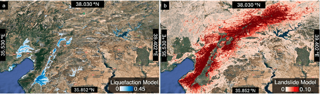

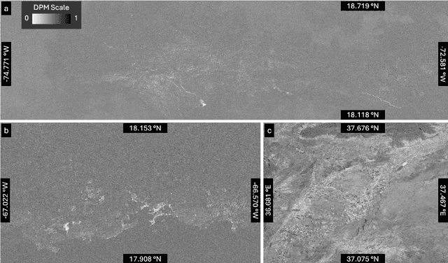

Post-earthquake hazard and impact estimation are critical for effective disaster response, yet current approaches face significant limitations. Traditional models employ fixed parameters regardless of geographical context, misrepresenting how seismic effects vary across diverse landscapes, while remote sensing technologies struggle to distinguish between co-located hazards. We address these challenges with a spatially-aware causal Bayesian network that decouples co-located hazards by modeling their causal relationships with location-specific parameters. Our framework integrates sensing observations, latent variables, and spatial heterogeneity through a novel combination of Gaussian Processes with normalizing flows, enabling us to capture how same earthquake produces different effects across varied geological and topographical features. Evaluations across three earthquakes demonstrate Spatial-VCBN achieves Area Under the Curve (AUC) improvements of up to 35.2% over existing methods. These results highlight the critical importance of modeling spatial heterogeneity in causal mechanisms for accurate disaster assessment, with direct implications for improving emergency response resource allocation.