Pierre Lassalle
CNES
A Cycle GAN Approach for Heterogeneous Domain Adaptation in Land Use Classification
Apr 22, 2020


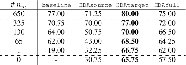
Abstract:In the field of remote sensing and more specifically in Earth Observation, new data are available every day, coming from different sensors. Leveraging on those data in classification tasks comes at the price of intense labelling tasks that are not realistic in operational settings. While domain adaptation could be useful to counterbalance this problem, most of the usual methods assume that the data to adapt are comparable (they belong to the same metric space), which is not the case when multiple sensors are at stake. Heterogeneous domain adaptation methods are a particular solution to this problem. We present a novel method to deal with such cases, based on a modified cycleGAN version that incorporates classification losses and a metric space alignment term. We demonstrate its power on a land use classification tasks, with images from both Google Earth and Sentinel-2.
Vehicle detection and counting from VHR satellite images: efforts and open issues
Oct 25, 2019


Abstract:Detection of new infrastructures (commercial, logistics, industrial or residential) from satellite images constitutes a proven method to investigate and follow economic and urban growth. The level of activities or exploitation of these sites may be hardly determined by building inspection, but could be inferred from vehicle presence from nearby streets and parking lots. We present in this paper two deep learning-based models for vehicle counting from optical satellite images coming from the Pleiades sensor at 50-cm spatial resolution. Both segmentation (Tiramisu) and detection (YOLO) architectures were investigated. These networks were adapted, trained and validated on a data set including 87k vehicles, annotated using an interactive semi-automatic tool developed by the authors. Experimental results show that both segmentation and detection models could achieve a precision rate higher than 85% with a recall rate also high (76.4% and 71.9% for Tiramisu and YOLO respectively).
 Add to Chrome
 Add to Firefox
 Add to Edge