 Add to Chrome
 Add to Firefox
 Add to Edge
Estimating Rural Path Loss with ITU-R P.1812-7 : Impact of Geospatial Inputs
Jan 20, 2025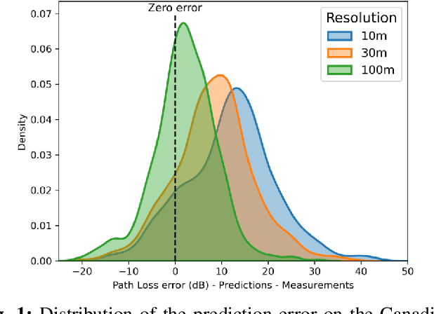


Accurate radio wave propagation modeling is essential for effective spectrum management by regulators and network deployment by operators. This paper investigates the ITU-R P.1812-7 (P.1812) propagation model's reliance on geospatial inputs, particularly clutter information, to improve path loss estimation, with an emphasis on rural geographic regions. The research evaluates the impact of geospatial elevation and land cover datasets, including Global Forest Canopy Height (GFCH), European Space Agency WorldCover, and Natural Resources Canada LandCover, on P.1812 propagation model prediction accuracy. Results highlight the trade-offs between dataset resolution, geospatial data availability, and representative clutter height assignments. Simulations reveal that high-resolution data do not always yield better results and that global datasets such as the GFCH provide a robust alternative when high-resolution data are unavailable or out-of-date. This study provides a set of guidelines for geospatial dataset integration to enhance P.1812's rural path loss predictions.
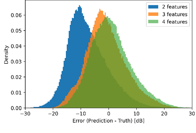
Path Loss Prediction Using Machine Learning with Extended Features
Jan 14, 2025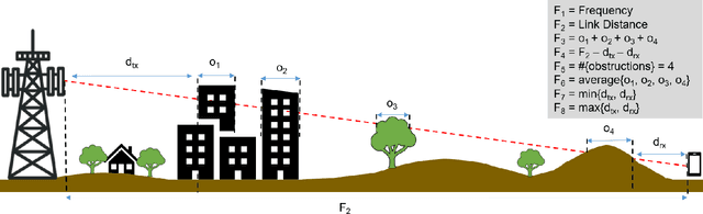
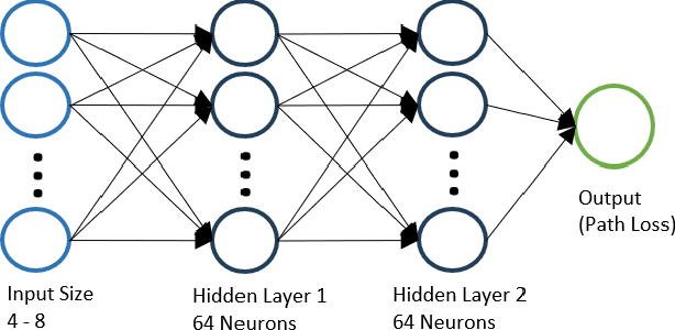
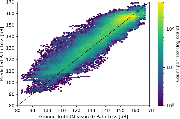
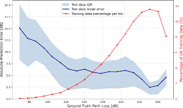
Wireless communications rely on path loss modeling, which is most effective when it includes the physical details of the propagation environment. Acquiring this data has historically been challenging, but geographic information system data is becoming increasingly available with higher resolution and accuracy. Access to such details enables propagation models to more accurately predict coverage and minimize interference in wireless deployments. Machine learning-based modeling can significantly support this effort, with feature-based approaches allowing for accurate, efficient, and scalable propagation modeling. Building on previous work, we introduce an extended set of features that improves prediction accuracy while, most importantly, maintaining model generalization across a broad range of environments.
Machine Learning-Based Path Loss Modeling with Simplified Features
May 16, 2024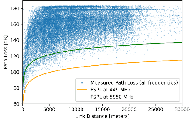
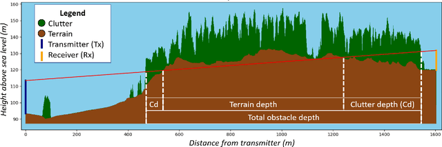
Propagation modeling is a crucial tool for successful wireless deployments and spectrum planning with the demand for high modeling accuracy continuing to grow. Recognizing that detailed knowledge of the physical environment (terrain and clutter) is essential, we propose a novel approach that uses environmental information for predictions. Instead of relying on complex, detail-intensive models, we explore the use of simplified scalar features involving the total obstruction depth along the direct path from transmitter to receiver. Obstacle depth offers a streamlined, yet surprisingly accurate, method for predicting wireless signal propagation, providing a practical solution for efficient and effective wireless network planning.