Mahdi Maktabdar Oghaz
Urban Tree Species Classification Using Aerial Imagery
Jul 07, 2021


Abstract:Urban trees help regulate temperature, reduce energy consumption, improve urban air quality, reduce wind speeds, and mitigating the urban heat island effect. Urban trees also play a key role in climate change mitigation and global warming by capturing and storing atmospheric carbon-dioxide which is the largest contributor to greenhouse gases. Automated tree detection and species classification using aerial imagery can be a powerful tool for sustainable forest and urban tree management. Hence, This study first offers a pipeline for generating labelled dataset of urban trees using Google Map's aerial images and then investigates how state of the art deep Convolutional Neural Network models such as VGG and ResNet handle the classification problem of urban tree aerial images under different parameters. Experimental results show our best model achieves an average accuracy of 60% over 6 tree species.
Content-aware Density Map for Crowd Counting and Density Estimation
Jun 17, 2019


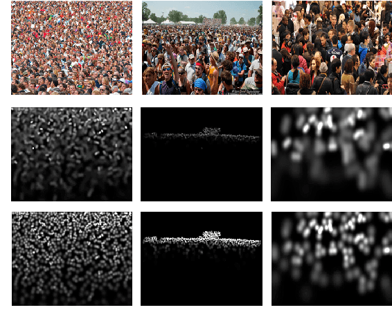
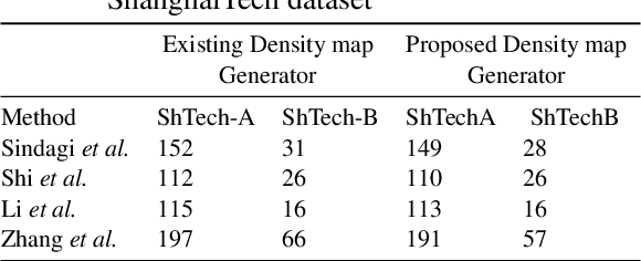
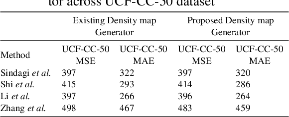
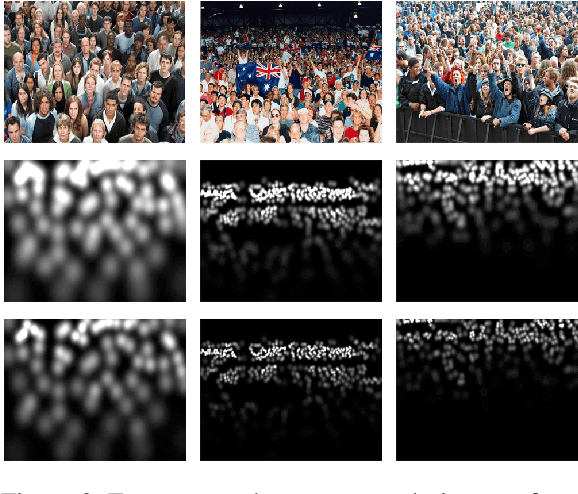
Abstract:Precise knowledge about the size of a crowd, its density and flow can provide valuable information for safety and security applications, event planning, architectural design and to analyze consumer behavior. Creating a powerful machine learning model, to employ for such applications requires a large and highly accurate and reliable dataset. Unfortunately the existing crowd counting and density estimation benchmark datasets are not only limited in terms of their size, but also lack annotation, in general too time consuming to implement. This paper attempts to address this very issue through a content aware technique, uses combinations of Chan-Vese segmentation algorithm, two-dimensional Gaussian filter and brute-force nearest neighbor search. The results shows that by simply replacing the commonly used density map generators with the proposed method, higher level of accuracy can be achieved using the existing state of the art models.
Scene and Environment Monitoring Using Aerial Imagery and Deep Learning
Jun 06, 2019


Abstract:Unmanned Aerial vehicles (UAV) are a promising technology for smart farming related applications. Aerial monitoring of agriculture farms with UAV enables key decision-making pertaining to crop monitoring. Advancements in deep learning techniques have further enhanced the precision and reliability of aerial imagery based analysis. The capabilities to mount various kinds of sensors (RGB, spectral cameras) on UAV allows remote crop analysis applications such as vegetation classification and segmentation, crop counting, yield monitoring and prediction, crop mapping, weed detection, disease and nutrient deficiency detection and others. A significant amount of studies are found in the literature that explores UAV for smart farming applications. In this paper, a review of studies applying deep learning on UAV imagery for smart farming is presented. Based on the application, we have classified these studies into five major groups including: vegetation identification, classification and segmentation, crop counting and yield predictions, crop mapping, weed detection and crop disease and nutrient deficiency detection. An in depth critical analysis of each study is provided.
* 8
 Add to Chrome
 Add to Firefox
 Add to Edge