M. Usman Maqbool Bhutta
Why-So-Deep: Towards Boosting Previously Trained Models for Visual Place Recognition
Jan 10, 2022


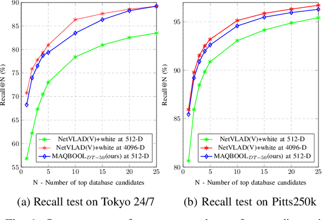
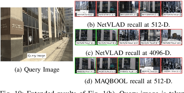
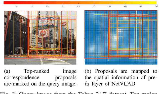
Abstract:Deep learning-based image retrieval techniques for the loop closure detection demonstrate satisfactory performance. However, it is still challenging to achieve high-level performance based on previously trained models in different geographical regions. This paper addresses the problem of their deployment with simultaneous localization and mapping (SLAM) systems in the new environment. The general baseline approach uses additional information, such as GPS, sequential keyframes tracking, and re-training the whole environment to enhance the recall rate. We propose a novel approach for improving image retrieval based on previously trained models. We present an intelligent method, MAQBOOL, to amplify the power of pre-trained models for better image recall and its application to real-time multiagent SLAM systems. We achieve comparable image retrieval results at a low descriptor dimension (512-D), compared to the high descriptor dimension (4096-D) of state-of-the-art methods. We use spatial information to improve the recall rate in image retrieval on pre-trained models.
PCR-Pro: 3D Sparse and Different Scale Point Clouds Registration and Robust Estimation of Information Matrix For Pose Graph SLAM
Aug 29, 2018


Abstract:For both indoor and outdoor environments, we propose an efficient and novel method for different scales and sparse 3D point clouds registration that cannot be handled by the current popular ICP approaches. Our algorithm efficiently detects the scale difference between point clouds and uses the keyframes to estimate the relative pose for calculating the scale difference. The algorithm applies a filter and computes the final transformation which coverages to a global minimum. The good estimation of transform and scale helps in the calculation of the covariance matrix using a closed form solution efficiently. This covariance between point clouds helps in the estimation of information matrix for pose-graph SLAM.
 Add to Chrome
 Add to Firefox
 Add to Edge