Kosuke Hatai
Estimating Sunlight Using GNSS Signal Strength from Smartphone
Aug 09, 2022


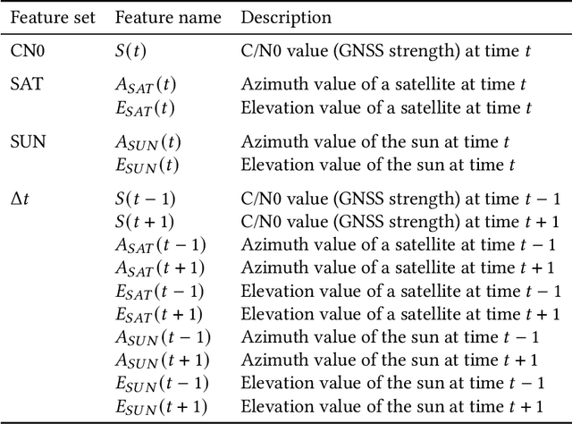
Abstract:Excessive or inadequate exposure to ultraviolet light (UV) is harmful to health and causes osteoporosis, colon cancer, and skin cancer. The UV Index, a standard scale of UV light, tends to increase in sunny places and sharply decrease in the shade. A method for distinguishing shady and sunny places would help us to prevent and cure diseases caused by UV. However, the existing methods, such as carrying UV sensors, impose a load on the user, whereas city-level UV forecasts do not have enough granularity for monitoring an individual's UV exposure. This paper proposes a method to detect sunny and shady places by using an off-the-shelf mobile device. The method detects these places by using a characteristic of the GNSS signal strength that is attenuated by objects around the device. As a dataset, we collected GNSS signal data, such as C/N0, satellite ID, satellite angle, and sun angle, together with reference data (i.e., sunny and shady place information every minute) for four days from five locations. Using the dataset, we created twelve classification models by using supervised machine learning methods and evaluated their performance by 4-fold cross-validation. In addition, we investigated the feature importance and the effect of combining features. The performance evaluation showed that our classification model could classify sunny and shady places with more than 97% accuracy in the best case. Moreover, our investigation revealed that the value of C/N0 at a moment and its time series (i.e., C/N0 value before and after the moment) are more important features.
 Add to Chrome
 Add to Firefox
 Add to Edge