Jessenia Gonzalez
Applying Knowledge Transfer for Water Body Segmentation in Peru
Dec 02, 2019


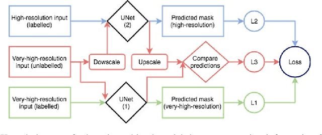
Abstract:In this work, we present the application of convolutional neural networks for segmenting water bodies in satellite images. We first use a variant of the U-Net model to segment rivers and lakes from very high-resolution images from Peru. To circumvent the issue of scarce labelled data, we investigate the applicability of a knowledge transfer-based model that learns the mapping from high-resolution labelled images and combines it with the very high-resolution mapping so that better segmentation can be achieved. We train this model in a single process, end-to-end. Our preliminary results show that adding the information from the available high-resolution images does not help out-of-the-box, and in fact worsen results. This leads us to infer that the high-resolution data could be from a different distribution, and its addition leads to increased variance in our results.
 Add to Chrome
 Add to Firefox
 Add to Edge