Huy-Hoang Ngo
Quadrotor Trajectory Tracking Using Linear and Nonlinear Model Predictive Control
Nov 11, 2024Abstract:Accurate trajectory tracking is an essential characteristic for the safe navigation of a quadrotor in cluttered or disturbed environments. In this paper, we present in detail two state-of-the-art model-based control frameworks for trajectory tracking: the Linear Model Predictive Controller (LMPC) and the Nonlinear Model Predictive Controller (NMPC). Additionally, the kinematic and dynamic models of the quadrotor are comprehensively described. Finally, a simulation system is implemented to verify feasibility, demonstrating the effectiveness of both controllers.
Flight Time Improvement Using Adaptive Model Predictive Control for Unmanned Aerial Vehicles
Nov 11, 2024Abstract:Intelligent aerial platforms such as Unmanned Aerial Vehicles (UAVs) are expected to revolutionize various fields, including transportation, traffic management, field monitoring, industrial production, and agricultural management. Among these, precise control is a critical task that determines the performance and capabilities of UAV systems. However, current research primarily focuses on trajectory tracking and minimizing flight errors, with limited attention to improving flight time. In this paper, we propose a Model Predictive Control (MPC) approach aimed at minimizing flight time while addressing the limitations of the commonly used classical MPC controllers. Furthermore, the MPC method and its application for UAV control are presented in detail. Finally, the results demonstrate that the proposed controller outperforms the standard MPC in terms of efficiency. Moreover, this approach shows potential to become a foundation for integrating intelligent algorithms into basic controllers.
Toward Integrating Semantic-aware Path Planning and Reliable Localization for UAV Operations
Nov 04, 2024


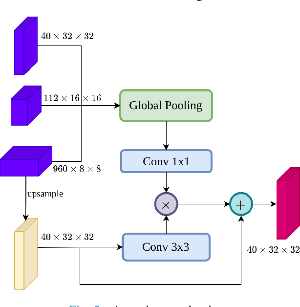
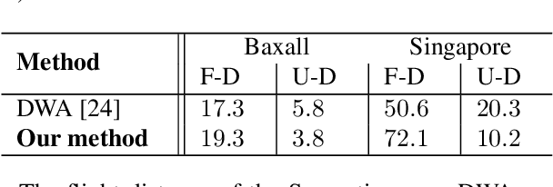
Abstract:Localization is one of the most crucial tasks for Unmanned Aerial Vehicle systems (UAVs) directly impacting overall performance, which can be achieved with various sensors and applied to numerous tasks related to search and rescue operations, object tracking, construction, etc. However, due to the negative effects of challenging environments, UAVs may lose signals for localization. In this paper, we present an effective path-planning system leveraging semantic segmentation information to navigate around texture-less and problematic areas like lakes, oceans, and high-rise buildings using a monocular camera. We introduce a real-time semantic segmentation architecture and a novel keyframe decision pipeline to optimize image inputs based on pixel distribution, reducing processing time. A hierarchical planner based on the Dynamic Window Approach (DWA) algorithm, integrated with a cost map, is designed to facilitate efficient path planning. The system is implemented in a photo-realistic simulation environment using Unity, aligning with segmentation model parameters. Comprehensive qualitative and quantitative evaluations validate the effectiveness of our approach, showing significant improvements in the reliability and efficiency of UAV localization in challenging environments.
 Add to Chrome
 Add to Firefox
 Add to Edge