Hongzhao Zheng
Data-Driven Spectrum Demand Prediction: A Spatio-Temporal Framework with Transfer Learning
Aug 05, 2025Abstract:Accurate spectrum demand prediction is crucial for informed spectrum allocation, effective regulatory planning, and fostering sustainable growth in modern wireless communication networks. It supports governmental efforts, particularly those led by the international telecommunication union (ITU), to establish fair spectrum allocation policies, improve auction mechanisms, and meet the requirements of emerging technologies such as advanced 5G, forthcoming 6G, and the internet of things (IoT). This paper presents an effective spatio-temporal prediction framework that leverages crowdsourced user-side key performance indicators (KPIs) and regulatory datasets to model and forecast spectrum demand. The proposed methodology achieves superior prediction accuracy and cross-regional generalizability by incorporating advanced feature engineering, comprehensive correlation analysis, and transfer learning techniques. Unlike traditional ITU models, which are often constrained by arbitrary inputs and unrealistic assumptions, this approach exploits granular, data-driven insights to account for spatial and temporal variations in spectrum utilization. Comparative evaluations against ITU estimates, as the benchmark, underscore our framework's capability to deliver more realistic and actionable predictions. Experimental results validate the efficacy of our methodology, highlighting its potential as a robust approach for policymakers and regulatory bodies to enhance spectrum management and planning.
Realistic Channel and Delay Coefficient Generation for Dual Mobile Space-Ground Links - A Tutorial-
May 07, 2024
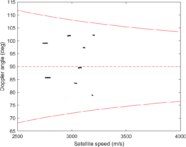
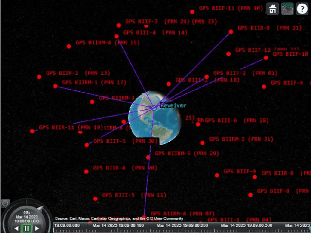
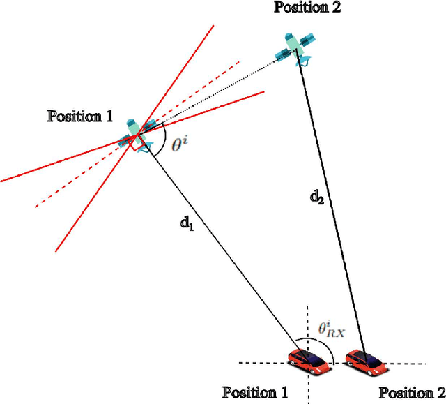
Abstract:Channel and delay coefficient are two essential parameters for the characterization of a multipath propagation environment. It is crucial to generate realistic channel and delay coefficient in order to study the channel characteristics that involves signals propagating through environments with severe multipath effects. While many deterministic channel models, such as ray-tracing (RT), face challenges like high computational complexity, data requirements for geometrical information, and inapplicability for space-ground links, and nongeometry-based stochastic channel models (NGSCMs) might lack spatial consistency and offer lower accuracy, we present a scalable tutorial for the channel modeling of dual mobile space-ground links in urban areas, utilizing the Quasi Deterministic Radio Channel Generator (QuaDRiGa), which adopts a geometry-based stochastic channel model (GSCM), in conjunction with an International Telecommunication Union (ITU) provided state duration model. This tutorial allows for the generation of realistic channel and delay coefficients in a multipath environment for dual mobile space-ground links. We validate the accuracy of the work by analyzing the generated channel and delay coefficient from several aspects, such as received signal power and amplitude, multipath delay distribution, delay spread and Doppler spectrum.
Synthetic Waveform Generation for Satellite, HAPS, and 5G Base Station Positioning Reference Signal Using QuaDRiGa
Jan 24, 2024


Abstract:Waveform generation is essential for studying signal propagation and channel characteristics, particularly for objects that are conceptualized but still need to be operational. We introduce a comprehensive guide on creating synthetic signals using channel and delay coefficients derived from the Quasi-Deterministic Radio Channel Generator (QuaDRiGa), which is recognized as a 3GPP-3D and 3GPP 38.901 reference implementation. The effectiveness of the proposed synthetic waveform generation method is validated through accurate estimation of code delay and Doppler shift. This validation is achieved using both the parallel code phase search technique and the conventional tracking method applied to satellites. As the method of integrating channel and delay coefficients to create synthetic waveforms is the same for satellite, HAPS, and gNB PRS, validating this method on synthetic satellite signals could potentially be extended to HAPS and gNB PRS as well. This study could significantly contribute to the field of heterogeneous navigation systems.
Analysis of a HAPS-Aided GNSS in Urban Areas using a RAIM Algorithm
Jan 02, 2023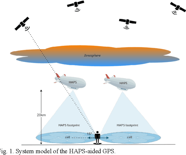
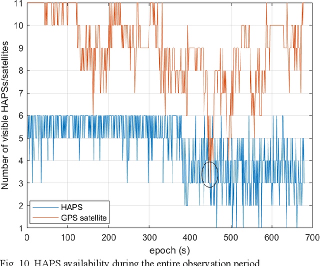
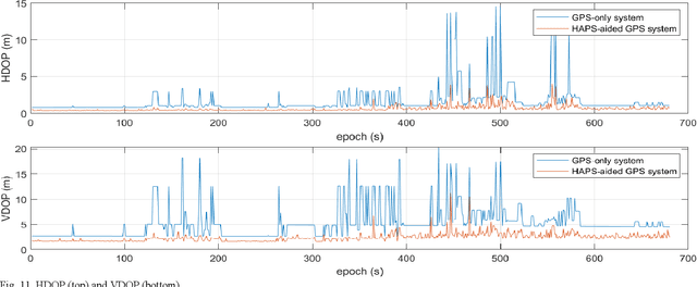
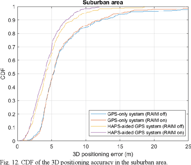
Abstract:The global averaged civilian positioning accuracy is still at meter level for all existing Global Navigation Satellite Systems (GNSSs), and the performance is even worse in urban areas. At lower altitudes than satellites, high altitude platform stations (HAPS) offer several benefits, such as lower latency, less pathloss, and likely smaller overall estimation error for the parameters associated in the pseudorange equation. HAPS can support GNSSs in many ways, and in this paper we treat the HAPS as another type of ranging source. In so doing, we examine the positioning performance of a HAPS-aided GPS system in an urban area using both a simulation and physical experiment. The HAPS measurements are unavailable today; therefore, they are modeled in a rather simple but logical manner in both the simulation and physical experiment. We show that the HAPS can improve the horizontal dilution of precision (HDOP), the vertical dilution of precision (VDOP), and the 3D positioning accuracy of GPS in both suburban and dense urban areas. We also demonstrate the applicability of a RAIM algorithm for the HAPS-aided GPS system, especially in the dense urban area.
High Altitude Platform Station -Aided GNSS for Urban Areas
Jan 02, 2023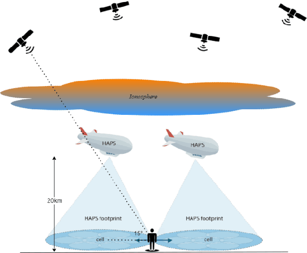
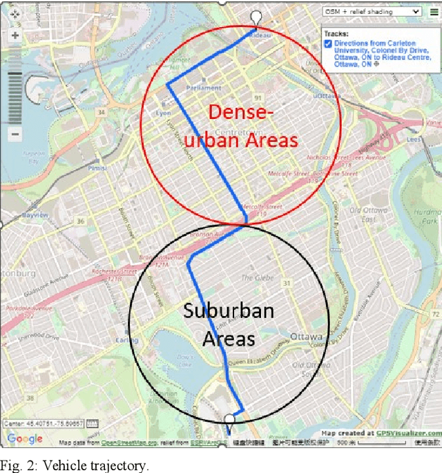
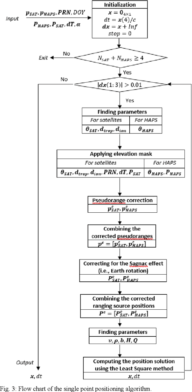
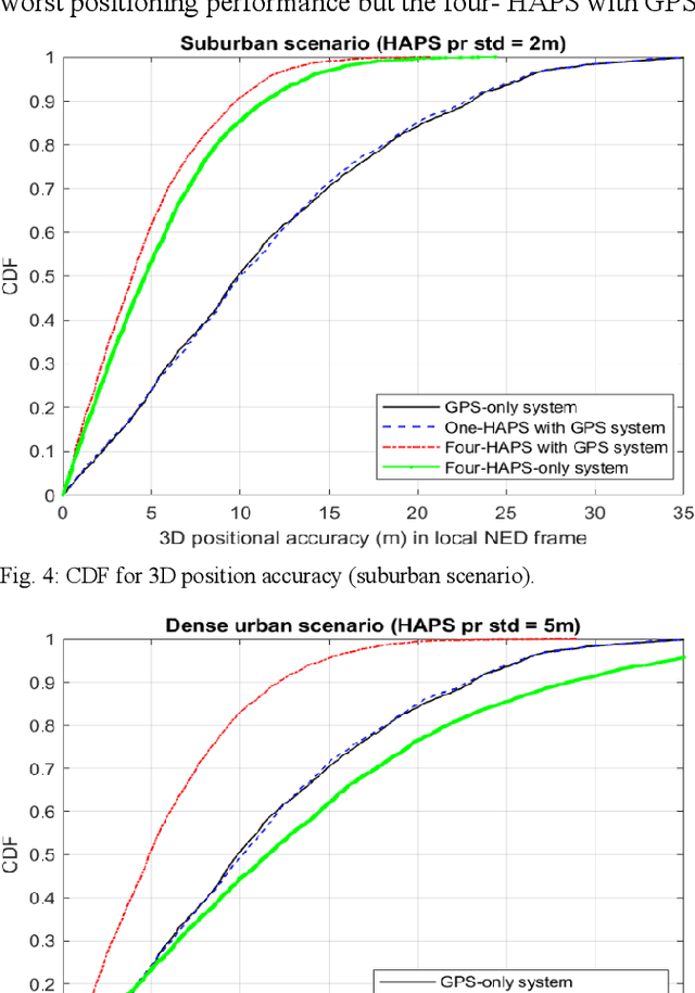
Abstract:Today the global averaged civilian positioning accuracy is still at meter level for all existing Global Navigation Satellite Systems (GNSSs), and the civilian positioning performance is even worse in regions such as the Arctic region and the urban areas. In this work, we examine the positioning performance of the High Altitude Platform Station (HAPS)-aided GPS system in an urban area via both simulation and physical experiment. HAPS can support GNSS in many ways, herein we treat the HAPS as an additional ranging source. From both simulation and experiment results, we can observe that HAPS can improve the horizontal dilution of precision (HDOP) and the 3D positioning accuracy. The simulated positioning performance of the HAPS-aided GPS system is subject to the estimation accuracy of the receiver clock offset. This work also presents the future work and challenges in modelling the pseudorange of HAPS.
 Add to Chrome
 Add to Firefox
 Add to Edge