Analysis of a HAPS-Aided GNSS in Urban Areas using a RAIM Algorithm
Paper and Code
Jan 02, 2023


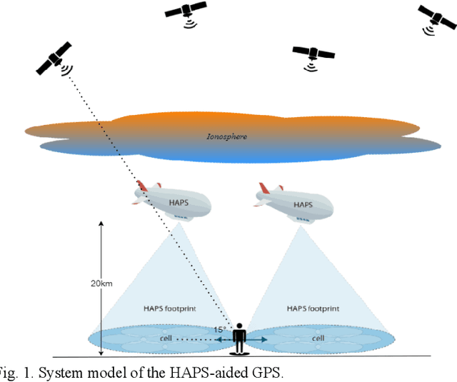
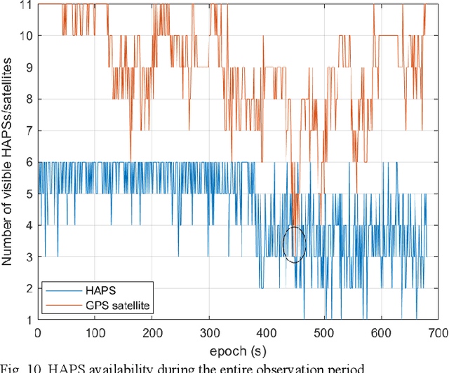
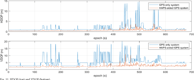
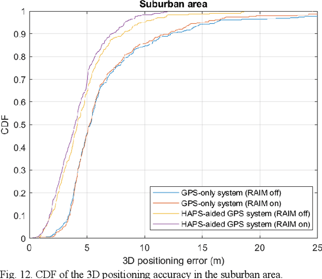
The global averaged civilian positioning accuracy is still at meter level for all existing Global Navigation Satellite Systems (GNSSs), and the performance is even worse in urban areas. At lower altitudes than satellites, high altitude platform stations (HAPS) offer several benefits, such as lower latency, less pathloss, and likely smaller overall estimation error for the parameters associated in the pseudorange equation. HAPS can support GNSSs in many ways, and in this paper we treat the HAPS as another type of ranging source. In so doing, we examine the positioning performance of a HAPS-aided GPS system in an urban area using both a simulation and physical experiment. The HAPS measurements are unavailable today; therefore, they are modeled in a rather simple but logical manner in both the simulation and physical experiment. We show that the HAPS can improve the horizontal dilution of precision (HDOP), the vertical dilution of precision (VDOP), and the 3D positioning accuracy of GPS in both suburban and dense urban areas. We also demonstrate the applicability of a RAIM algorithm for the HAPS-aided GPS system, especially in the dense urban area.
 Add to Chrome
 Add to Firefox
 Add to Edge