Gyri Reiersen
ReforesTree: A Dataset for Estimating Tropical Forest Carbon Stock with Deep Learning and Aerial Imagery
Jan 26, 2022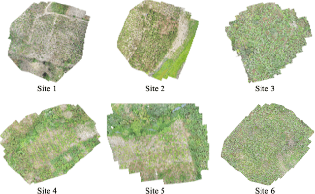
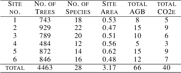
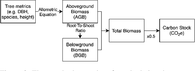
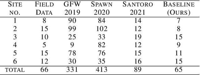
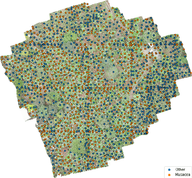
Abstract:Forest biomass is a key influence for future climate, and the world urgently needs highly scalable financing schemes, such as carbon offsetting certifications, to protect and restore forests. Current manual forest carbon stock inventory methods of measuring single trees by hand are time, labour, and cost-intensive and have been shown to be subjective. They can lead to substantial overestimation of the carbon stock and ultimately distrust in forest financing. The potential for impact and scale of leveraging advancements in machine learning and remote sensing technologies is promising but needs to be of high quality in order to replace the current forest stock protocols for certifications. In this paper, we present ReforesTree, a benchmark dataset of forest carbon stock in six agro-forestry carbon offsetting sites in Ecuador. Furthermore, we show that a deep learning-based end-to-end model using individual tree detection from low cost RGB-only drone imagery is accurately estimating forest carbon stock within official carbon offsetting certification standards. Additionally, our baseline CNN model outperforms state-of-the-art satellite-based forest biomass and carbon stock estimates for this type of small-scale, tropical agro-forestry sites. We present this dataset to encourage machine learning research in this area to increase accountability and transparency of monitoring, verification and reporting (MVR) in carbon offsetting projects, as well as scaling global reforestation financing through accurate remote sensing.
Tackling the Overestimation of Forest Carbon with Deep Learning and Aerial Imagery
Aug 19, 2021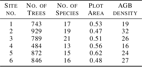
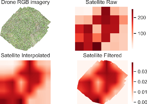
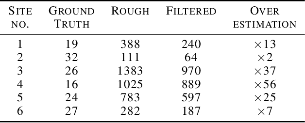
Abstract:Forest carbon offsets are increasingly popular and can play a significant role in financing climate mitigation, forest conservation, and reforestation. Measuring how much carbon is stored in forests is, however, still largely done via expensive, time-consuming, and sometimes unaccountable field measurements. To overcome these limitations, many verification bodies are leveraging machine learning (ML) algorithms to estimate forest carbon from satellite or aerial imagery. Aerial imagery allows for tree species or family classification, which improves the satellite imagery-based forest type classification. However, aerial imagery is significantly more expensive to collect and it is unclear by how much the higher resolution improves the forest carbon estimation. This proposal paper describes the first systematic comparison of forest carbon estimation from aerial imagery, satellite imagery, and ground-truth field measurements via deep learning-based algorithms for a tropical reforestation project. Our initial results show that forest carbon estimates from satellite imagery can overestimate above-ground biomass by up to 10-times for tropical reforestation projects. The significant difference between aerial and satellite-derived forest carbon measurements shows the potential for aerial imagery-based ML algorithms and raises the importance to extend this study to a global benchmark between options for carbon measurements.
 Add to Chrome
 Add to Firefox
 Add to Edge