Goh Siow Mong Rick
Don't Forget What I did?: Assessing Client Contributions in Federated Learning
Mar 11, 2024


Abstract:Federated Learning (FL) is a collaborative machine learning (ML) approach, where multiple clients participate in training an ML model without exposing the private data. Fair and accurate assessment of client contributions is an important problem in FL to facilitate incentive allocation and encouraging diverse clients to participate in a unified model training. Existing methods for assessing client contribution adopts co-operative game-theoretic concepts, such as Shapley values, but under simplified assumptions. In this paper, we propose a history-aware game-theoretic framework, called FLContrib, to assess client contributions when a subset of (potentially non-i.i.d.) clients participate in each epoch of FL training. By exploiting the FL training process and linearity of Shapley value, we develop FLContrib that yields a historical timeline of client contributions as FL training progresses over epochs. Additionally, to assess client contribution under limited computational budget, we propose a scheduling procedure that considers a two-sided fairness criteria to perform expensive Shapley value computation only in a subset of training epochs. In experiments, we demonstrate a controlled trade-off between the correctness and efficiency of client contributions assessed via FLContrib. To demonstrate the benefits of history-aware client contributions, we apply FLContrib to detect dishonest clients conducting data poisoning in FL training.
FedUKD: Federated UNet Model with Knowledge Distillation for Land Use Classification from Satellite and Street Views
Dec 05, 2022


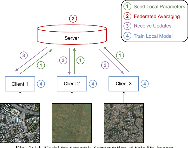
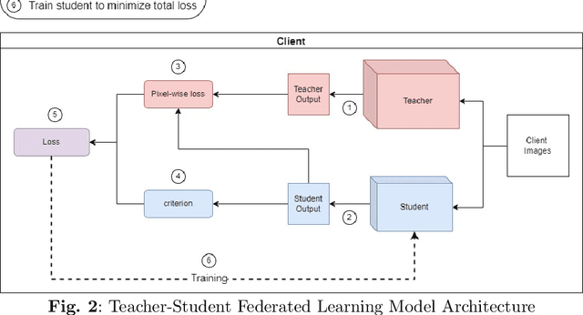
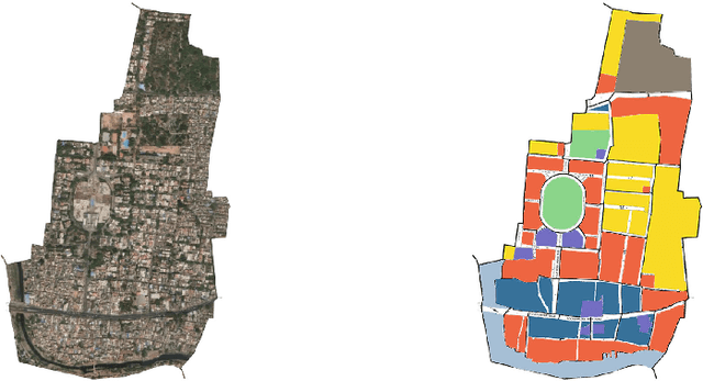
Abstract:Federated Deep Learning frameworks can be used strategically to monitor Land Use locally and infer environmental impacts globally. Distributed data from across the world would be needed to build a global model for Land Use classification. The need for a Federated approach in this application domain would be to avoid transfer of data from distributed locations and save network bandwidth to reduce communication cost. We use a Federated UNet model for Semantic Segmentation of satellite and street view images. The novelty of the proposed architecture is the integration of Knowledge Distillation to reduce communication cost and response time. The accuracy obtained was above 95% and we also brought in a significant model compression to over 17 times and 62 times for street View and satellite images respectively. Our proposed framework has the potential to be a game-changer in real-time tracking of climate change across the planet.
 Add to Chrome
 Add to Firefox
 Add to Edge