Filippo Biondi
Synthetic Aperture Radar Doppler Tomography Reveals Details of Undiscovered High-Resolution Internal Structure of the Great Pyramid of Giza
Aug 01, 2022


Abstract:A problem with synthetic aperture radar (SAR) is that, due to the poor penetrating action of electromagnetic waves inside solid bodies, the capability to observe inside distributed targets is precluded. Under these conditions, imaging action is provided only on the surface of distributed targets. The present work describes an imaging method based on the analysis of micro-movements on the Khnum-Khufu Pyramid, which are usually generated by background seismic waves. The results obtained prove to be very promising, as high-resolution full 3D tomographic imaging of the pyramid's interior and subsurface was achieved. Khnum-Khufu becomes transparent like a crystal when observed in the micro-movement domain. Based on this novelty, we have completely reconstructed internal objects, observing and measuring structures that have never been discovered before. The experimental results are estimated by processing series of SAR images from the second-generation Italian COSMO-SkyMed satellite system, demonstrating the effectiveness of the proposed method.
Scanning Inside Volcanoes by Synthetic Aperture Radar Echography Tomographic Doppler Imaging
Jun 18, 2022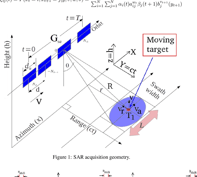
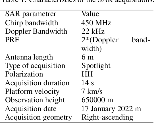


Abstract:A problem with synthetic aperture radar (SAR) is that due to the poor penetrating action of electromagnetic waves within solid bodies, the ability to observe through distributed targets is precluded. In this context, indeed, imaging is only possible on targets distribute on the scene surface. This work describes an imaging method based on the analysis of micro-motions present on volcanoes and generated by the underground Earth's heat. Processing the coherent vibrational information embedded on the single SAR image, in the single-look-complex configuration, the sound information is exploited, penetrating tomographic imaging over a depth of about 3 km from the Earth's surface. Measurement results are calculated by processing a SLC image from the COSMO-SkyMed Second Generation satellite constellation of the Vesuvius. Tomographic maps reveal the presence of the magma chamber, together with the main and the secondary volcanic conduits. This technique certainly paves the way for completely new exploitation of SAR images to scan inside the Earth's surface.
Unsupervised Sparse Unmixing of Atmospheric Trace Gases from Hyperspectral Satellite Data
Jan 14, 2022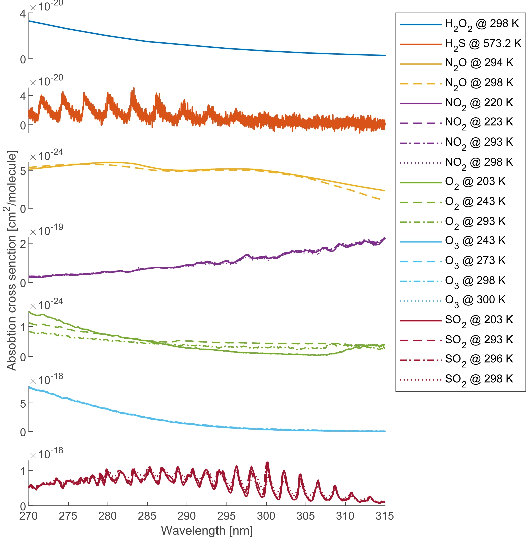

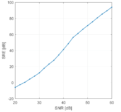

Abstract:In this letter, a new approach for the retrieval of the vertical column concentrations of trace gases from hyperspectral satellite observations, is proposed. The main idea is to perform a linear spectral unmixing by estimating the abundances of trace gases spectral signatures in each mixed pixel collected by an imaging spectrometer in the ultraviolet region. To this aim, the sparse nature of the measurements is brought to light and the compressive sensing paradigm is applied to estimate the concentrations of the gases' endemembers given by an a priori wide spectral library, including reference cross sections measured at different temperatures and pressures at the same time. The proposed approach has been experimentally assessed using both simulated and real hyperspectral dataset. Specifically, the experimental analysis relies on the retrieval of sulfur dioxide during volcanic emissions using data collected by the TROPOspheric Monitoring Instrument. To validate the procedure, we also compare the obtained results with the sulfur dioxide total column product based on the differential optical absorption spectroscopy technique and the retrieved concentrations estimated using the blind source separation.
EM-based Solutions for Covariance Structure Detection and Classification in Polarimetric SAR Images
Jun 21, 2021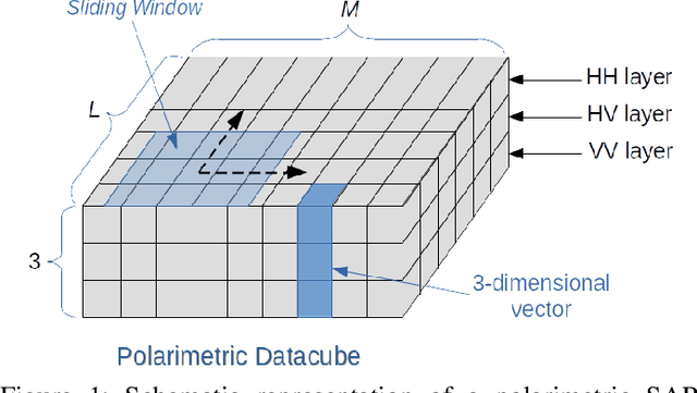

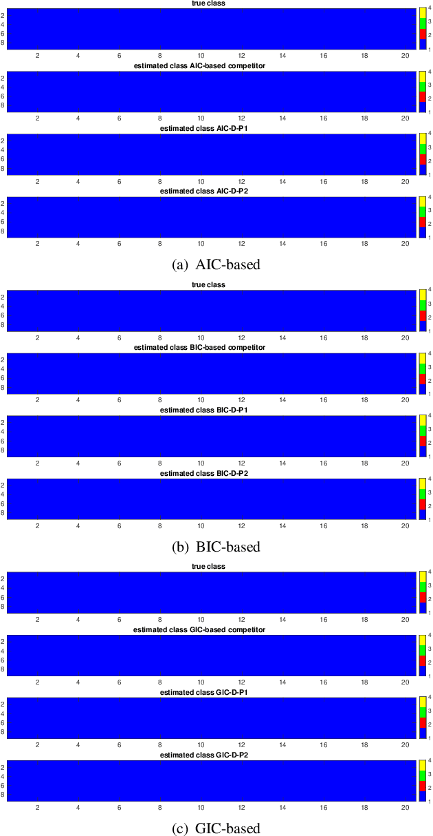
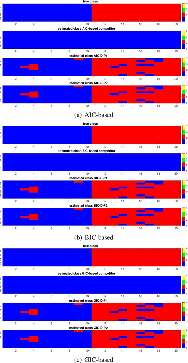
Abstract:This paper addresses the challenge of classifying polarimetric SAR images by leveraging the peculiar characteristics of the polarimetric covariance matrix (PCM). To this end, a general framework to solve a multiple hypothesis test is introduced with the aim to detect and classify contextual spatial variations in polarimetric SAR images. Specifically, under the null hypothesis, only an unknown structure is assumed for data belonging to a 2-dimensional spatial sliding window, whereas under each alternative hypothesis, data are partitioned into subsets sharing different structures. The problem of partition estimation is solved by resorting to hidden random variables representative of covariance structure classes and the expectation-maximization algorithm. The effectiveness of the proposed detection strategies is demonstrated on both simulated and real polarimetric SAR data also in comparison with existing classification algorithms.
Towards Monocular Digital Elevation Model (DEM) Estimation by Convolutional Neural Networks - Application on Synthetic Aperture Radar Images
Mar 14, 2018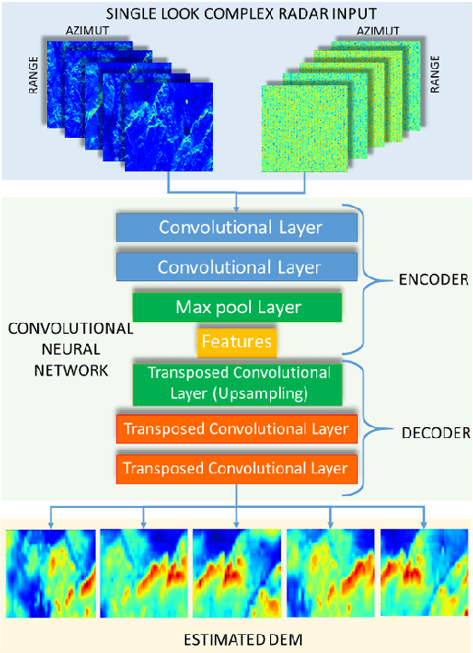
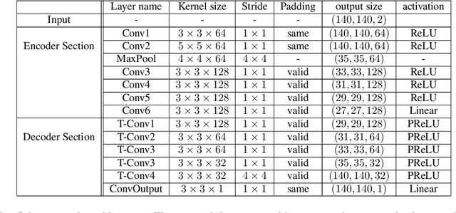


Abstract:Synthetic aperture radar (SAR) interferometry (InSAR) is performed using repeat-pass geometry. InSAR technique is used to estimate the topographic reconstruction of the earth surface. The main problem of the range-Doppler focusing technique is the nature of the two-dimensional SAR result, affected by the layover indetermination. In order to resolve this problem, a minimum of two sensor acquisitions, separated by a baseline and extended in the cross-slant-range, are needed. However, given its multi-temporal nature, these techniques are vulnerable to atmosphere and Earth environment parameters variation in addition to physical platform instabilities. Furthermore, either two radars are needed or an interferometric cycle is required (that spans from days to weeks), which makes real time DEM estimation impossible. In this work, the authors propose a novel experimental alternative to the InSAR method that uses single-pass acquisitions, using a data driven approach implemented by Deep Neural Networks. We propose a fully Convolutional Neural Network (CNN) Encoder-Decoder architecture, training it on radar images in order to estimate DEMs from single pass image acquisitions. Our results on a set of Sentinel images show that this method is able to learn to some extent the statistical properties of the DEM. The results of this exploratory analysis are encouraging and open the way to the solution of single-pass DEM estimation problem with data driven approaches.
 Add to Chrome
 Add to Firefox
 Add to Edge