Emanuele Strano
Outlining where humans live -- The World Settlement Footprint 2015
Oct 28, 2019


Abstract:Human settlements are the cause and consequence of most environmental and societal changes on Earth; however, their location and extent is still under debate. We provide here a new 10m resolution (0.32 arc sec) global map of human settlements on Earth for the year 2015, namely the World Settlement Footprint 2015 (WSF2015). The raster dataset has been generated by means of an advanced classification system which, for the first time, jointly exploits open-and-free optical and radar satellite imagery. The WSF2015 has been validated against 900,000 samples labelled by crowdsourcing photointerpretation of very high resolution Google Earth imagery and outperforms all other similar existing layers; in particular, it considerably improves the detection of very small settlements in rural regions and better outlines scattered suburban areas. The dataset can be used at any scale of observation in support to all applications requiring detailed and accurate information on human presence (e.g., socioeconomic development, population distribution, risks assessment, etc.).
Spatial sensitivity analysis for urban land use prediction with physics-constrained conditional generative adversarial networks
Jul 22, 2019


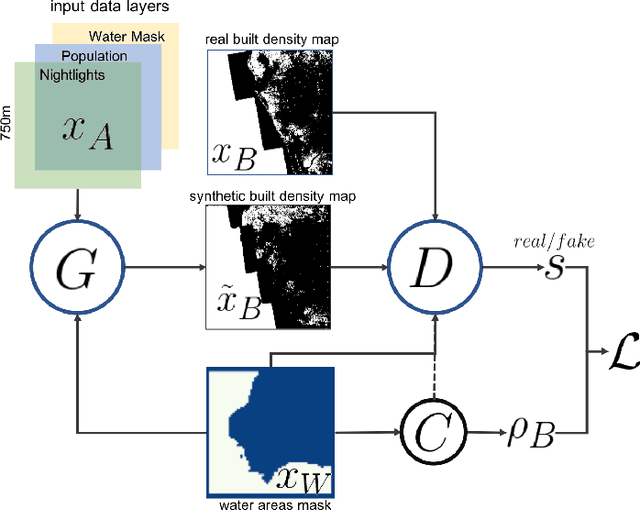
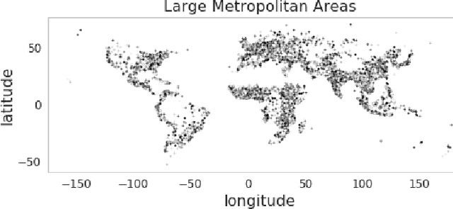
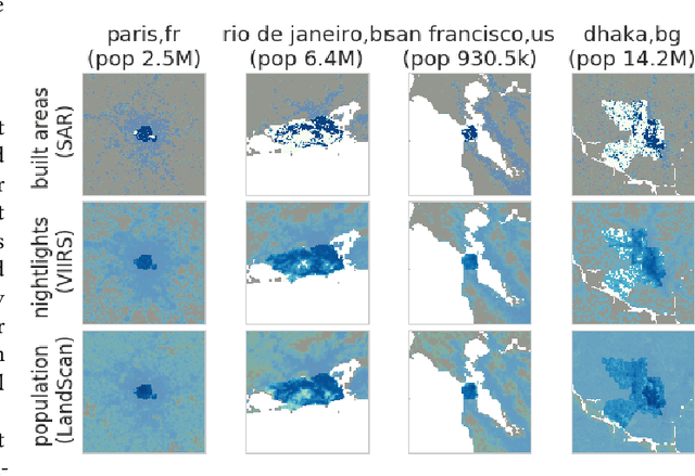
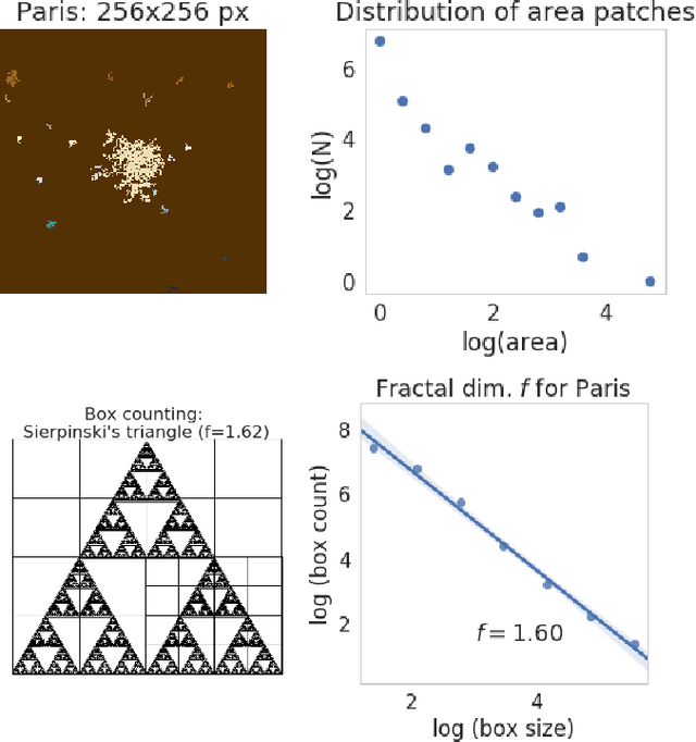
Abstract:Accurately forecasting urban development and its environmental and climate impacts critically depends on realistic models of the spatial structure of the built environment, and of its dependence on key factors such as population and economic development. Scenario simulation and sensitivity analysis, i.e., predicting how changes in underlying factors at a given location affect urbanization outcomes at other locations, is currently not achievable at a large scale with traditional urban growth models, which are either too simplistic, or depend on detailed locally-collected socioeconomic data that is not available in most places. Here we develop a framework to estimate, purely from globally-available remote-sensing data and without parametric assumptions, the spatial sensitivity of the (\textit{static}) rate of change of urban sprawl to key macroeconomic development indicators. We formulate this spatial regression problem as an image-to-image translation task using conditional generative adversarial networks (GANs), where the gradients necessary for comparative static analysis are provided by the backpropagation algorithm used to train the model. This framework allows to naturally incorporate physical constraints, e.g., the inability to build over water bodies. To validate the spatial structure of model-generated built environment distributions, we use spatial statistics commonly used in urban form analysis. We apply our method to a novel dataset comprising of layers on the built environment, nightlighs measurements (a proxy for economic development and energy use), and population density for the world's most populous 15,000 cities.
Modeling urbanization patterns with generative adversarial networks
Jan 08, 2018


Abstract:In this study we propose a new method to simulate hyper-realistic urban patterns using Generative Adversarial Networks trained with a global urban land-use inventory. We generated a synthetic urban "universe" that qualitatively reproduces the complex spatial organization observed in global urban patterns, while being able to quantitatively recover certain key high-level urban spatial metrics.
 Add to Chrome
 Add to Firefox
 Add to Edge