Chenxin Yu
Perception-aware Planning for Quadrotor Flight in Unknown and Feature-limited Environments
Mar 19, 2025


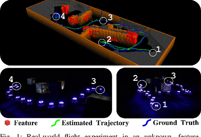
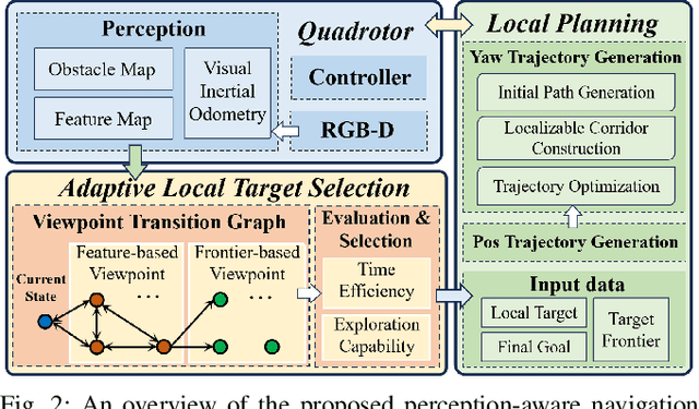
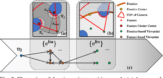
Abstract:Various studies on perception-aware planning have been proposed to enhance the state estimation accuracy of quadrotors in visually degraded environments. However, many existing methods heavily rely on prior environmental knowledge and face significant limitations in previously unknown environments with sparse localization features, which greatly limits their practical application. In this paper, we present a perception-aware planning method for quadrotor flight in unknown and feature-limited environments that properly allocates perception resources among environmental information during navigation. We introduce a viewpoint transition graph that allows for the adaptive selection of local target viewpoints, which guide the quadrotor to efficiently navigate to the goal while maintaining sufficient localizability and without being trapped in feature-limited regions. During the local planning, a novel yaw trajectory generation method that simultaneously considers exploration capability and localizability is presented. It constructs a localizable corridor via feature co-visibility evaluation to ensure localization robustness in a computationally efficient way. Through validations conducted in both simulation and real-world experiments, we demonstrate the feasibility and real-time performance of the proposed method. The source code will be released to benefit the community.
 Add to Chrome
 Add to Firefox
 Add to Edge