Brian Barker
Resilient In-Season Crop Type Classification in Multispectral Satellite Observations using Growth Stage Normalization
Sep 21, 2020


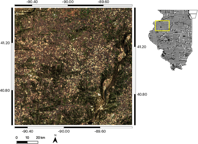
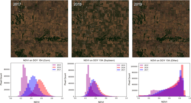
Abstract:Crop type classification using satellite observations is an important tool for providing insights about planted area and enabling estimates of crop condition and yield, especially within the growing season when uncertainties around these quantities are highest. As the climate changes and extreme weather events become more frequent, these methods must be resilient to changes in domain shifts that may occur, for example, due to shifts in planting timelines. In this work, we present an approach for within-season crop type classification using moderate spatial resolution (30 m) satellite data that addresses domain shift related to planting timelines by normalizing inputs by crop growth stage. We use a neural network leveraging both convolutional and recurrent layers to predict if a pixel contains corn, soybeans, or another crop or land cover type. We evaluated this method for the 2019 growing season in the midwestern US, during which planting was delayed by as much as 1-2 months due to extreme weather that caused record flooding. We show that our approach using growth stage-normalized time series outperforms fixed-date time series, and achieves overall classification accuracy of 85.4% prior to harvest (September-November) and 82.8% by mid-season (July-September).
Rapid Response Crop Maps in Data Sparse Regions
Jun 23, 2020


Abstract:Spatial information on cropland distribution, often called cropland or crop maps, are critical inputs for a wide range of agriculture and food security analyses and decisions. However, high-resolution cropland maps are not readily available for most countries, especially in regions dominated by smallholder farming (e.g., sub-Saharan Africa). These maps are especially critical in times of crisis when decision makers need to rapidly design and enact agriculture-related policies and mitigation strategies, including providing humanitarian assistance, dispersing targeted aid, or boosting productivity for farmers. A major challenge for developing crop maps is that many regions do not have readily accessible ground truth data on croplands necessary for training and validating predictive models, and field campaigns are not feasible for collecting labels for rapid response. We present a method for rapid mapping of croplands in regions where little to no ground data is available. We present results for this method in Togo, where we delivered a high-resolution (10 m) cropland map in under 10 days to facilitate rapid response to the COVID-19 pandemic by the Togolese government. This demonstrated a successful transition of machine learning applications research to operational rapid response in a real humanitarian crisis. All maps, data, and code are publicly available to enable future research and operational systems in data-sparse regions.
 Add to Chrome
 Add to Firefox
 Add to Edge