Benjamin Brodie
Fine-Grained Property Value Assessment using Probabilistic Disaggregation
May 31, 2023Abstract:The monetary value of a given piece of real estate, a parcel, is often readily available from a geographic information system. However, for many applications, such as insurance and urban planning, it is useful to have estimates of property value at much higher spatial resolutions. We propose a method to estimate the distribution over property value at the pixel level from remote sensing imagery. We evaluate on a real-world dataset of a major urban area. Our results show that the proposed approaches are capable of generating fine-level estimates of property values, significantly improving upon a diverse collection of baseline approaches.
Causality for Inherently Explainable Transformers: CAT-XPLAIN
Jun 29, 2022


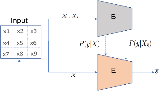
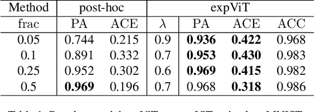
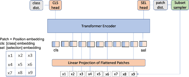
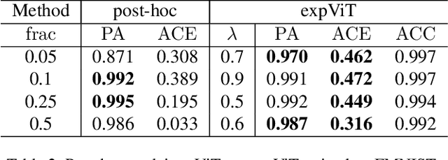
Abstract:There have been several post-hoc explanation approaches developed to explain pre-trained black-box neural networks. However, there is still a gap in research efforts toward designing neural networks that are inherently explainable. In this paper, we utilize a recently proposed instance-wise post-hoc causal explanation method to make an existing transformer architecture inherently explainable. Once trained, our model provides an explanation in the form of top-$k$ regions in the input space of the given instance contributing to its decision. We evaluate our method on binary classification tasks using three image datasets: MNIST, FMNIST, and CIFAR. Our results demonstrate that compared to the causality-based post-hoc explainer model, our inherently explainable model achieves better explainability results while eliminating the need of training a separate explainer model. Our code is available at https://github.com/mvrl/CAT-XPLAIN.
 Add to Chrome
 Add to Firefox
 Add to Edge