Virtual laser scanning with HELIOS++: A novel take on ray tracing-based simulation of topographic 3D laser scanning
Paper and Code
Jan 21, 2021


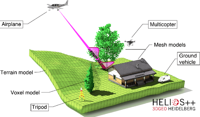
Topographic laser scanning is a remote sensing method to create detailed 3D point cloud representations of the Earth's surface. Since data acquisition is expensive, simulations can complement real data given certain premises are available: i) a model of 3D scene and scanner, ii) a model of the beam-scene interaction, simplified to a computationally feasible while physically realistic level, and iii) an application for which simulated data is fit for use. A number of laser scanning simulators for different purposes exist, which we enrich by presenting HELIOS++. HELIOS++ is an open-source simulation framework for terrestrial static, mobile, UAV-based and airborne laser scanning implemented in C++. The HELIOS++ concept provides a flexible solution for the trade-off between physical accuracy (realism) and computational complexity (runtime, memory footprint), as well as ease of use and of configuration. Unique features of HELIOS++ include the availability of Python bindings (pyhelios) for controlling simulations, and a range of model types for 3D scene representation. HELIOS++ further allows the simulation of beam divergence using a subsampling strategy, and is able to create full-waveform outputs as a basis for detailed analysis. As generation and analysis of waveforms can strongly impact runtimes, the user may set the level of detail for the subsampling, or optionally disable full-waveform output altogether. A detailed assessment of computational considerations and a comparison of HELIOS++ to its predecessor, HELIOS, reveal reduced runtimes by up to 83 %. At the same time, memory requirements are reduced by up to 94 %, allowing for much larger (i.e. more complex) 3D scenes to be loaded into memory and hence to be virtually acquired by laser scanning simulation.
 Add to Chrome
 Add to Firefox
 Add to Edge