U-TILISE: A Sequence-to-sequence Model for Cloud Removal in Optical Satellite Time Series
Paper and Code
May 22, 2023


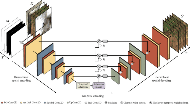
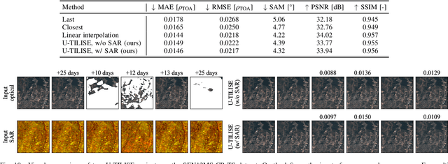
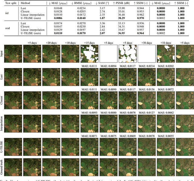
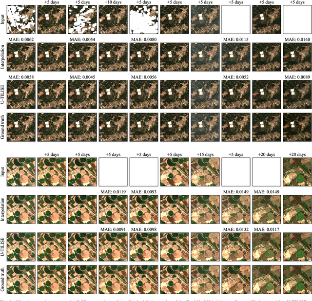
Satellite image time series in the optical and infrared spectrum suffer from frequent data gaps due to cloud cover, cloud shadows, and temporary sensor outages. It has been a long-standing problem of remote sensing research how to best reconstruct the missing pixel values and obtain complete, cloud-free image sequences. We approach that problem from the perspective of representation learning and develop U-TILISE, an efficient neural model that is able to implicitly capture spatio-temporal patterns of the spectral intensities, and that can therefore be trained to map a cloud-masked input sequence to a cloud-free output sequence. The model consists of a convolutional spatial encoder that maps each individual frame of the input sequence to a latent encoding; an attention-based temporal encoder that captures dependencies between those per-frame encodings and lets them exchange information along the time dimension; and a convolutional spatial decoder that decodes the latent embeddings back into multi-spectral images. We experimentally evaluate the proposed model on EarthNet2021, a dataset of Sentinel-2 time series acquired all over Europe, and demonstrate its superior ability to reconstruct the missing pixels. Compared to a standard interpolation baseline, it increases the PSNR by 1.8 dB at previously seen locations and by 1.3 dB at unseen locations.
 Add to Chrome
 Add to Firefox
 Add to Edge