Topology Preserving Local Road Network Estimation from Single Onboard Camera Image
Paper and Code
Dec 19, 2021


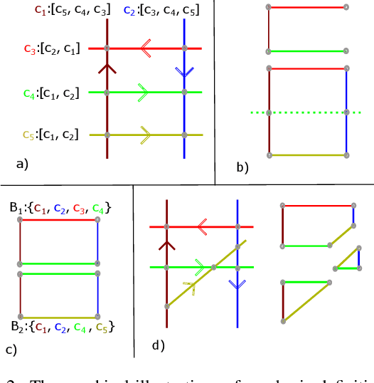
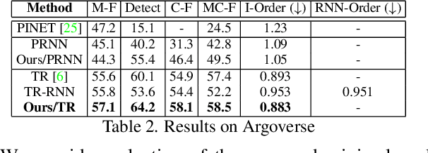
Knowledge of the road network topology is crucial for autonomous planning and navigation. Yet, recovering such topology from a single image has only been explored in part. Furthermore, it needs to refer to the ground plane, where also the driving actions are taken. This paper aims at extracting the local road network topology, directly in the bird's-eye-view (BEV), all in a complex urban setting. The only input consists of a single onboard, forward looking camera image. We represent the road topology using a set of directed lane curves and their interactions, which are captured using their intersection points. To better capture topology, we introduce the concept of \emph{minimal cycles} and their covers. A minimal cycle is the smallest cycle formed by the directed curve segments (between two intersections). The cover is a set of curves whose segments are involved in forming a minimal cycle. We first show that the covers suffice to uniquely represent the road topology. The covers are then used to supervise deep neural networks, along with the lane curve supervision. These learn to predict the road topology from a single input image. The results on the NuScenes and Argoverse benchmarks are significantly better than those obtained with baselines. Our source code will be made publicly available.
 Add to Chrome
 Add to Firefox
 Add to Edge