 Add to Chrome
 Add to Firefox
 Add to Edge
Self-Supervised Traversability Learning with Online Prototype Adaptation for Off-Road Autonomous Driving
Paper and Code
Apr 16, 2025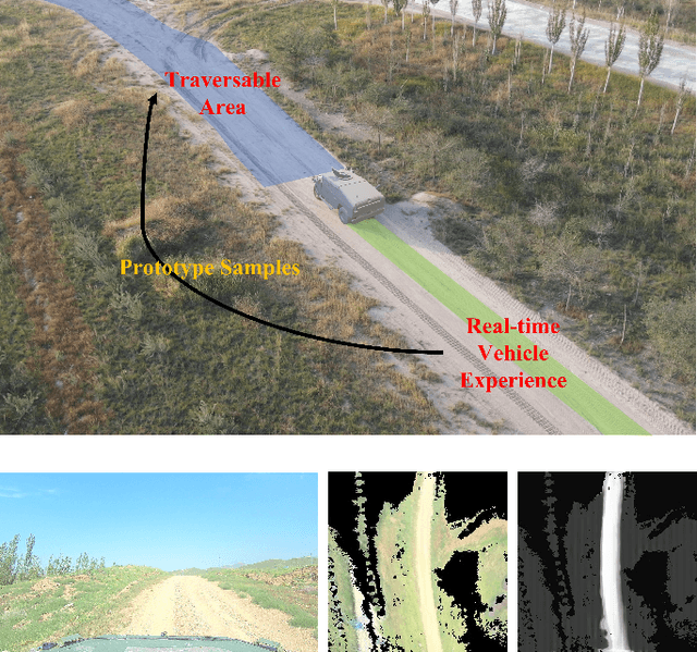
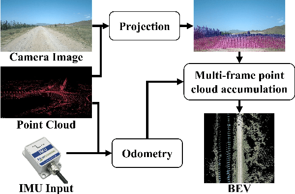
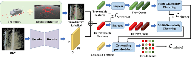
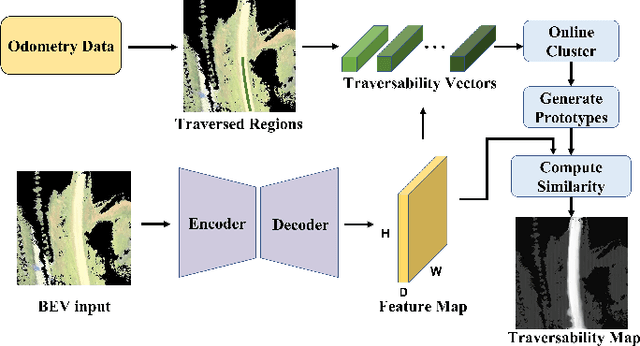
Achieving reliable and safe autonomous driving in off-road environments requires accurate and efficient terrain traversability analysis. However, this task faces several challenges, including the scarcity of large-scale datasets tailored for off-road scenarios, the high cost and potential errors of manual annotation, the stringent real-time requirements of motion planning, and the limited computational power of onboard units. To address these challenges, this paper proposes a novel traversability learning method that leverages self-supervised learning, eliminating the need for manual annotation. For the first time, a Birds-Eye View (BEV) representation is used as input, reducing computational burden and improving adaptability to downstream motion planning. During vehicle operation, the proposed method conducts online analysis of traversed regions and dynamically updates prototypes to adaptively assess the traversability of the current environment, effectively handling dynamic scene changes. We evaluate our approach against state-of-the-art benchmarks on both public datasets and our own dataset, covering diverse seasons and geographical locations. Experimental results demonstrate that our method significantly outperforms recent approaches. Additionally, real-world vehicle experiments show that our method operates at 10 Hz, meeting real-time requirements, while a 5.5 km autonomous driving experiment further validates the generated traversability cost maps compatibility with downstream motion planning.