Robust Fusion of LiDAR and Wide-Angle Camera Data for Autonomous Mobile Robots
Paper and Code
Aug 23, 2018


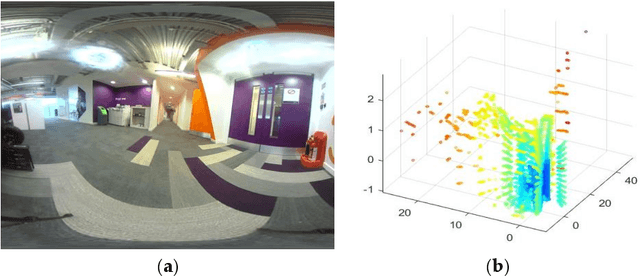
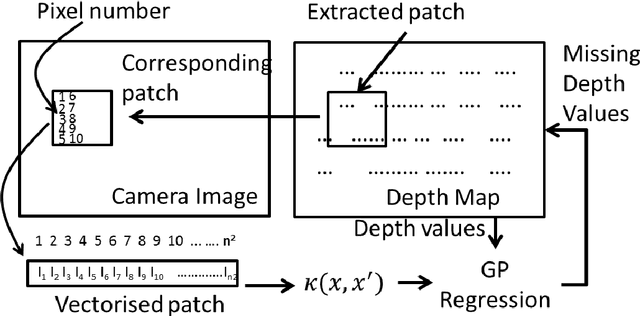
Autonomous robots that assist humans in day to day living tasks are becoming increasingly popular. Autonomous mobile robots operate by sensing and perceiving their surrounding environment to make accurate driving decisions. A combination of several different sensors such as LiDAR, radar, ultrasound sensors and cameras are utilized to sense the surrounding environment of autonomous vehicles. These heterogeneous sensors simultaneously capture various physical attributes of the environment. Such multimodality and redundancy of sensing need to be positively utilized for reliable and consistent perception of the environment through sensor data fusion. However, these multimodal sensor data streams are different from each other in many ways, such as temporal and spatial resolution, data format, and geometric alignment. For the subsequent perception algorithms to utilize the diversity offered by multimodal sensing, the data streams need to be spatially, geometrically and temporally aligned with each other. In this paper, we address the problem of fusing the outputs of a Light Detection and Ranging (LiDAR) scanner and a wide-angle monocular image sensor for free space detection. The outputs of LiDAR scanner and the image sensor are of different spatial resolutions and need to be aligned with each other. A geometrical model is used to spatially align the two sensor outputs, followed by a Gaussian Process (GP) regression-based resolution matching algorithm to interpolate the missing data with quantifiable uncertainty. The results indicate that the proposed sensor data fusion framework significantly aids the subsequent perception steps, as illustrated by the performance improvement of a uncertainty aware free space detection algorithm
 Add to Chrome
 Add to Firefox
 Add to Edge