Maximum Temperature Prediction Using Remote Sensing Data Via Convolutional Neural Network
Paper and Code
May 31, 2024

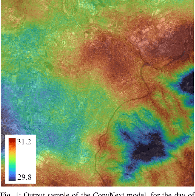
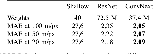
Urban heat islands, defined as specific zones exhibiting substantially higher temperatures than their immediate environs, pose significant threats to environmental sustainability and public health. This study introduces a novel machine-learning model that amalgamates data from the Sentinel-3 satellite, meteorological predictions, and additional remote sensing inputs. The primary aim is to generate detailed spatiotemporal maps that forecast the peak temperatures within a 24-hour period in Turin. Experimental results validate the model's proficiency in predicting temperature patterns, achieving a Mean Absolute Error (MAE) of 2.09 degrees Celsius for the year 2023 at a resolution of 20 meters per pixel, thereby enriching our knowledge of urban climatic behavior. This investigation enhances the understanding of urban microclimates, emphasizing the importance of cross-disciplinary data integration, and laying the groundwork for informed policy-making aimed at alleviating the negative impacts of extreme urban temperatures.
 Add to Chrome
 Add to Firefox
 Add to Edge