Iterative Deep Learning for Road Topology Extraction
Paper and Code
Aug 28, 2018


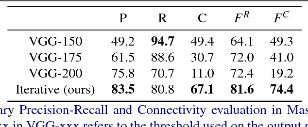
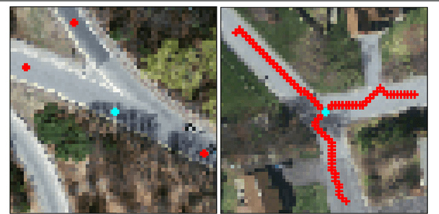
This paper tackles the task of estimating the topology of road networks from aerial images. Building on top of a global model that performs a dense semantical classification of the pixels of the image, we design a Convolutional Neural Network (CNN) that predicts the local connectivity among the central pixel of an input patch and its border points. By iterating this local connectivity we sweep the whole image and infer the global topology of the road network, inspired by a human delineating a complex network with the tip of their finger. We perform an extensive and comprehensive qualitative and quantitative evaluation on the road network estimation task, and show that our method also generalizes well when moving to networks of retinal vessels.
 Add to Chrome
 Add to Firefox
 Add to Edge