Dense Dilated Convolutions Merging Network for Land Cover Classification
Paper and Code
Mar 09, 2020


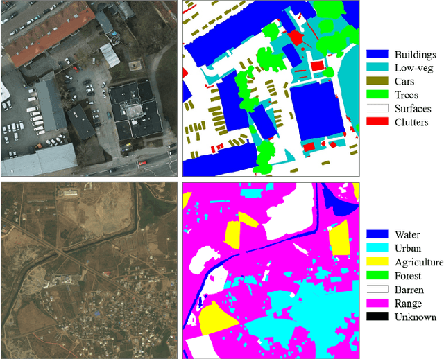
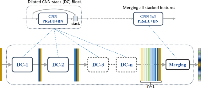
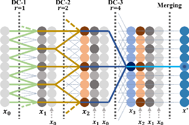
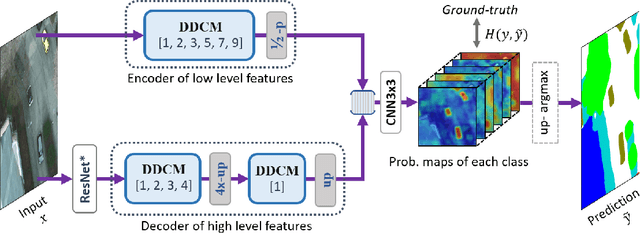
Land cover classification of remote sensing images is a challenging task due to limited amounts of annotated data, highly imbalanced classes, frequent incorrect pixel-level annotations, and an inherent complexity in the semantic segmentation task. In this article, we propose a novel architecture called the dense dilated convolutions' merging network (DDCM-Net) to address this task. The proposed DDCM-Net consists of dense dilated image convolutions merged with varying dilation rates. This effectively utilizes rich combinations of dilated convolutions that enlarge the network's receptive fields with fewer parameters and features compared with the state-of-the-art approaches in the remote sensing domain. Importantly, DDCM-Net obtains fused local- and global-context information, in effect incorporating surrounding discriminative capability for multiscale and complex-shaped objects with similar color and textures in very high-resolution aerial imagery. We demonstrate the effectiveness, robustness, and flexibility of the proposed DDCM-Net on the publicly available ISPRS Potsdam and Vaihingen data sets, as well as the DeepGlobe land cover data set. Our single model, trained on three-band Potsdam and Vaihingen data sets, achieves better accuracy in terms of both mean intersection over union (mIoU) and F1-score compared with other published models trained with more than three-band data. We further validate our model on the DeepGlobe data set, achieving state-of-the-art result 56.2% mIoU with much fewer parameters and at a lower computational cost compared with related recent work. Code available at https://github.com/samleoqh/DDCM-Semantic-Segmentation-PyTorch
 Add to Chrome
 Add to Firefox
 Add to Edge