DeepLCZChange: A Remote Sensing Deep Learning Model Architecture for Urban Climate Resilience
Paper and Code
Jun 09, 2023


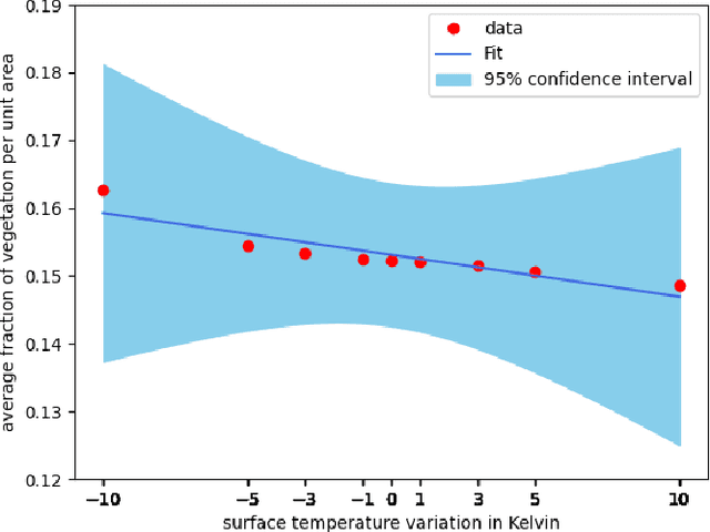
Urban land use structures impact local climate conditions of metropolitan areas. To shed light on the mechanism of local climate wrt. urban land use, we present a novel, data-driven deep learning architecture and pipeline, DeepLCZChange, to correlate airborne LiDAR data statistics with the Landsat 8 satellite's surface temperature product. A proof-of-concept numerical experiment utilizes corresponding remote sensing data for the city of New York to verify the cooling effect of urban forests.
* accepted for publication in 2023 IGARSS conference
 Add to Chrome
 Add to Firefox
 Add to Edge