Building Damage Assessment in Conflict Zones: A Deep Learning Approach Using Geospatial Sub-Meter Resolution Data
Paper and Code
Oct 07, 2024


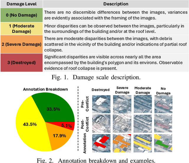
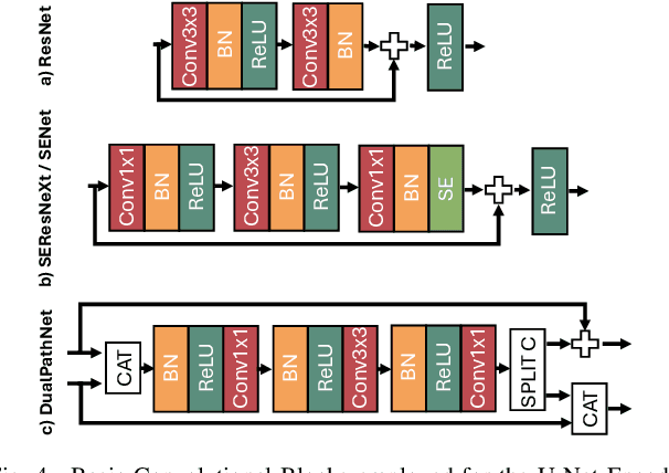
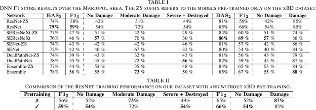
Very High Resolution (VHR) geospatial image analysis is crucial for humanitarian assistance in both natural and anthropogenic crises, as it allows to rapidly identify the most critical areas that need support. Nonetheless, manually inspecting large areas is time-consuming and requires domain expertise. Thanks to their accuracy, generalization capabilities, and highly parallelizable workload, Deep Neural Networks (DNNs) provide an excellent way to automate this task. Nevertheless, there is a scarcity of VHR data pertaining to conflict situations, and consequently, of studies on the effectiveness of DNNs in those scenarios. Motivated by this, our work extensively studies the applicability of a collection of state-of-the-art Convolutional Neural Networks (CNNs) originally developed for natural disasters damage assessment in a war scenario. To this end, we build an annotated dataset with pre- and post-conflict images of the Ukrainian city of Mariupol. We then explore the transferability of the CNN models in both zero-shot and learning scenarios, demonstrating their potential and limitations. To the best of our knowledge, this is the first study to use sub-meter resolution imagery to assess building damage in combat zones.
 Add to Chrome
 Add to Firefox
 Add to Edge