AstroLoc: Robust Space to Ground Image Localizer
Paper and Code
Feb 10, 2025


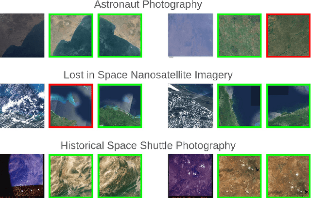
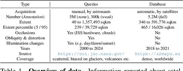
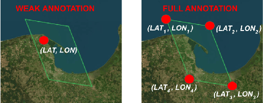
Astronauts take thousands of photos of Earth per day from the International Space Station, which, once localized on Earth's surface, are used for a multitude of tasks, ranging from climate change research to disaster management. The localization process, which has been performed manually for decades, has recently been approached through image retrieval solutions: given an astronaut photo, find its most similar match among a large database of geo-tagged satellite images, in a task called Astronaut Photography Localization (APL). Yet, existing APL approaches are trained only using satellite images, without taking advantage of the millions open-source astronaut photos. In this work we present the first APL pipeline capable of leveraging astronaut photos for training. We first produce full localization information for 300,000 manually weakly labeled astronaut photos through an automated pipeline, and then use these images to train a model, called AstroLoc. AstroLoc learns a robust representation of Earth's surface features through two losses: astronaut photos paired with their matching satellite counterparts in a pairwise loss, and a second loss on clusters of satellite imagery weighted by their relevance to astronaut photography via unsupervised mining. We find that AstroLoc achieves a staggering 35% average improvement in recall@1 over previous SOTA, pushing the limits of existing datasets with a recall@100 consistently over 99%. Finally, we note that AstroLoc, without any fine-tuning, provides excellent results for related tasks like the lost-in-space satellite problem and historical space imagery localization.
 Add to Chrome
 Add to Firefox
 Add to Edge