A Research and Strategy of Remote Sensing Image Denoising Algorithms
Paper and Code
May 24, 2019


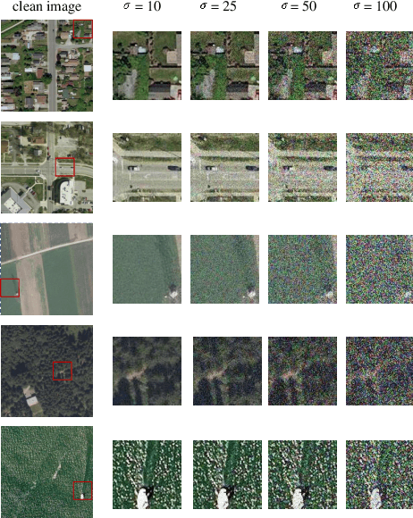
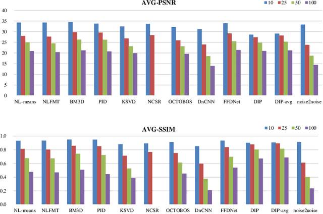
Most raw data download from satellites are useless, resulting in transmission waste, one solution is to process data directly on satellites, then only transmit the processed results to the ground. Image processing is the main data processing on satellites, in this paper, we focus on image denoising which is the basic image processing. There are many high-performance denoising approaches at present, however, most of them rely on advanced computing resources or rich images on the ground. Considering the limited computing resources of satellites and the characteristics of remote sensing images, we do some research on these high-performance ground image denoising approaches and compare them in simulation experiments to analyze whether they are suitable for satellites. According to the analysis results, we propose two feasible image denoising strategies for satellites based on satellite TianZhi-1.
 Add to Chrome
 Add to Firefox
 Add to Edge